Walter Crossley, “The Story Teller” continues his observations traveling on the North River.
FROM THE RAILROAD BRIDGE TO THE SEA.
Actually, our starting point just before Mary’s Boatyard heading downriver.
“On the Marshfield side just above Mary’s Boat Livery was a beautiful spring very close to the river. It was a favorite watering place for the early boatmen and it was also used for cattle. I well remember one bull that caused hurried retreats to the boats.
Mary’s livery was also a boat rental at that time and was operated by Mary Damon
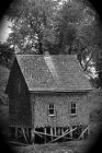
There was a stone embankment along the river that was used as a landing place, and two or three dorys were kept for rent. A boat house stood near the river.
I believe Miss Damon and her sister lived in a house that is now occupied by Mrs Williams. They also had a small building on the highway that was used as a store.”
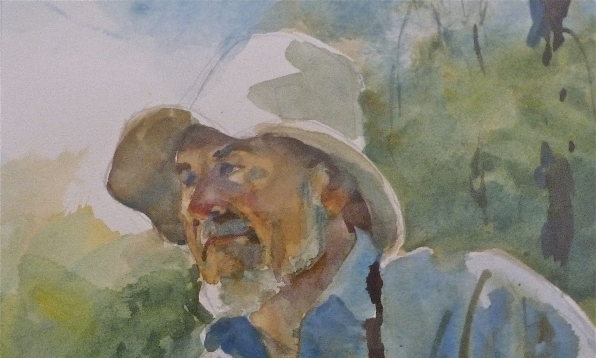
“The bridge at that time was a hand operated draw and the old toll house was still there, though no longer used. This was moved later, I believe and made into a dwelling which is still in existence. Just below the bridge was a one room dwelling set on wood pilings which was occupied by Mr. William Cann.”
“Known as Bill by all acquaintances he fished for lobsters from spring to fall . Some winters he went to Florida and singed on a fishing vessel there. He had an eighteen foot dory when I first knew him. Bill would row the dory from Little’s bridge out to sea, set trawl and then row back. Some times he rowed against the tide and wind and he always stood facing forward and pushing the oars. Later he acquired a 21 -foot dory with a three horsepower engine.”
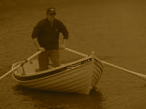
” I worked for him for several summers,usually Saturday and Sunday, sometimes during the week. Bill would leave at daylight to haul and my job was to go to his place and open up for customers. Lobsters were sold both alive and boiled,. Boiling was done on the cook stove and a wash boiler was used as the cooking utensil. I chopped wood for the wood fire that furnished the heat. I often wonder what that temperature was reached in that shanty on an August day. I also wonder what the present day board of health would have said about the process.”
“Live lobsters were kept in a hole in the meadow where the boatyard is now located on the Scituate shore. This called for a trip across the river when more lobsters were needed.”
“Cars were becoming fairly common and on a good weekend brought many customers. The price ran as high as 50 cents for boiled and 35 for green. In my spare time I repaired traps , rigged them and cut wood, time never hung heavy.”
Bill usually returned between 1 and 2 p.m. and relieved me for the rest of the day. Sometimes I caught flounder and sculpin to use as bait , the standard price was one cent per fish.”
Below Bill’s place was a long sand bar that extended from the Marshfield shore. It still exists but is now somewhat broken up and covered with mud and mussels. A that time it was firm sand and a good clam flat that gave me plenty of bushels.””
This bar was a very definite menace to navigation and because the channel was so close to Scituate, many an unlucky boatman spent some time stranded on the sand. The only navigational aids were an occasional pole or birch tree stuck in the mud by someone.”
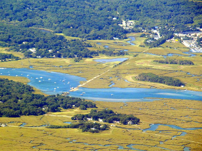 From the bottom up; Macombers Ridge with the road running between the Ridge and Barttlet’s Island to Trount’s Island (not seen). The point on the left is Damon’s point with the former railroad bed running through & across the marsh to Greenbush. The white dot alone in the center of the river is where the wreck of the “Emma” lays. Will’s Island is above right. As you can see the river is squeezed up through the old RR bridge crossing.
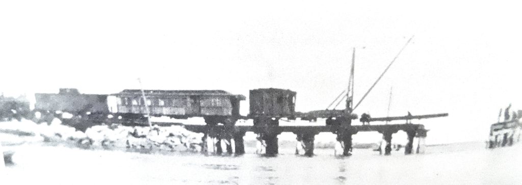
RAILROAD BRIDGE
“The next point to be noted was the railroad bridge. The original bridge was very low, so low that even a row boat could not pass under at high tide. Another small bridge over a side channel offered a little more height , but the narrow span and very strong tide made this dangerous. I know of at least one drowning here and of several capsizes in which were narrow escapes.”
“This bridge was not a draw and when boat passage was demanded, a work train equipped with a crane had to be dispatched from Boston.
The central section of the bridge was then taken apart , rails, unbolted and pulled up, cross ties removed and swung to the side. The process was reversed after the boat went through. It was entertaining to watch.”
“One enterprising individual living upriver brought quite a large sailing boat equipped with power and announced that he would take deep sea fishing parties every weekend weather permitting . After two or three trips of dismantling the bridge, the sailboat disappeared. The talk of the time was the railroad bought him out. I offer this for what it is worth. I have no confirmation.”
“The tide ran diagonally through this bridge and was always very strong. Long piers at right angles to the bridge added to hazards of the boatsman. I have seen the water at least one foot higher on one side than the other, making it impossible to row, in fact many of early power boats were unable to go against it. Once committed to with the tide, there was no turning back. Many an unlucky skipper was caught by the current and bounced off one pier or another as he moved downstream.”
“The bridge was replaced in 1910 or 1911. The new one was about three feet higher and had a draw operated by manpower and a concrete counter balance. The entire track across the marshes was raised about the time the new bridge went in. A side track was built at Damon’s Point and trackmen had temporary quarters in railroad cars there. it was entertaining to spend to spend an evening with them.”
“The railroad bridge stayed in service until train service was discontinued in the late 30’s.”
“The small bridge on the Scituate side was removed and the channel was filled. The Scituate end of the main span was removed, the Marshfield side was left ad eventually was turned into the present pier and declared a town landing . There still a very strong and confused current here at certain tides and should be treated with respect by all boatsmen.”
“This part of the river, from the railroad bridge to the inlet, has had more physical change than any other place. Small groups of cottages were at several places such as Damon’s Point, where I live. Wills Island in the Scituate marsh, Bartlett’s , Macombers, Cherry, Trounts, and Ameses all on the Marshfield . These were all unfinished inside shingled or tar -papered on the outside. They were only intended only for weekend or vacation use.”
“Bartletts is practically deserted and is proposed as a real estate development. Almost all the ones at Damond’s Point have been rebuilt into year-round homes.”
“Town water, electricity, and telephone service have been brought in with the old railroad bed being made into a blacktop road.
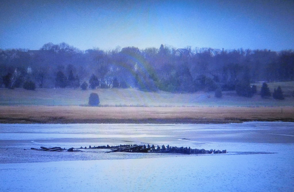
There was a large mussel bed dividing the river into two channels just below the bridge but now has disappeared . This bar was built up by an old sailing vessel converted to a coal carrier, and towed in and anchored to the Marshfield bank about 1912. This hull diverted the tide, made a new channel between it and the bank while the eddy it created on the upstream side filled with sediment, creating the present shoal. The hulk was burned to the water line on a Fourth of July evening.”
 The “Emma”
Looking from Damon’s Point to Scituate.
APPROACHING THE NEW INLET.
“The mussel beds at Herring River were not there . Instead a long point of meadow extended between the two streams with deep water on either side. This area, known as the Herring River bank, was one of the favorite fishing spots. Flounder, cod, pollock, and an occasional tautog could be had almost any time of tide. ”
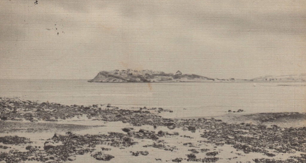
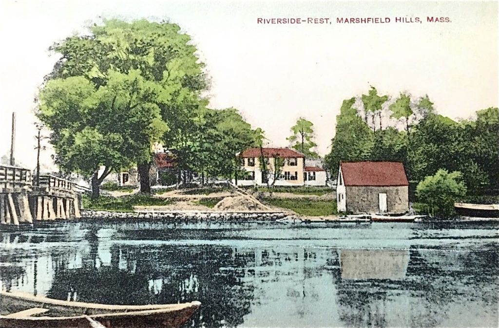
This is the beach at Rivermore, the southwest side of Third Cliff, and looking across the New Inlet to Fourth Cliff. The lone building is a hotel.
“The sandy point of Third Cliff I believe was at least half a mile farther out to sea than it is now. I know from certain bearings on the hills that we used as navigational aids . I have dug many clams on the Marshfield flats where the present point is.”
“The mouth itself was narrow. A very strong tide and tide rips were there that make the present ones look small were common. Almost every ebb tide created them regardless of wind.Rowboats and even some small power boats caught in this tide were frequently carried out to sea unless shore could be reached first. Fourth Cliff itself was much larger. The abandoned hotel now a Coast Guard Station at the south end and one small cottage were the only buildings .”
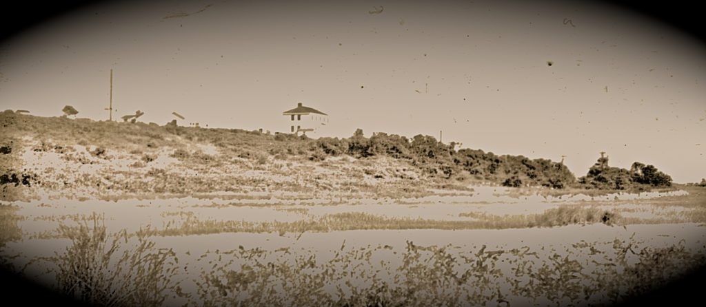
Fourth Cliff with a hotel.
“It was a favorite camping ground for many.
sI would like to see all the marsh and swamp area including some upland and all the islands established as a park, recreation area, or wildlife preserve, call it what you will and remove from private enterprise.”
By Walter E. Crossley. July 6, 1972.
I think Walter has traveled about 12 miles of the North River from Hanover to the Third & Fourth Cliff’s at the New Inlet.
There are numerous other observations of his on and near the North River that I have passed by for now.
These include Fishing, hunting, clamming, eeling, and his daily life.
I will post the “Story Tellers ” other observations from time to time.
W. Ray Freden.
Each article you present leaves me with so much more knowledge re Marshfield. Thank you my friend!
So interesting to learn about this area so many years ago, thinking how many changes have been made.
Thank you for the “wicked awesome” story that you posted here. I grew up on Rirverside Circle from 1957- 1969, I spent many days on the river. We went all the way up to the Rt. 53 bridge in Pembroke. My frien Tom Hale’s dad kept his lobster boat at Damon’s Point. We also gassed up at Mary’s, Skated on Nelson’s pond and even road our bikes down Nelson’s Hill. That was a scary ride. We camped out down at the end of Maryland St. while the Expressway was being built. Great memormies. Thx again.
And thank you Red, I too would boat to 53 & get fried clams at Jordan’s Clam Shack/house!
I knew Bob Hale, He could scull his skiff against an out going tide ! Coasting down Nelson’s Hill was scary ! And I would go parking off Maryland St (then West St) before the xway. In my day, there was a cart path across the marsh from West st. to a island next to the river & a summer camp there, the xway took care of that!
Dear Mr. Fredan,
I just recently discovered your posts and am loving them. So much wonderful information and memories. As a “newbie” to the Hills village (1973!) I really enjoy learning about this great town.
By the way, many years ago someone gave me one of your shorebirds for Christmas. I loved it and thought it a real treasure. Several years later, over Memorial Day weekend (the Arts Festival weekend in the Hills, my office was broken into and among the few things stolen, your shorebird was taken. The police came, and told me that thieves had really pre-cased the area and had that day broken into several small outbuildings, of different natures, already knowing exactly what they wanted. Of course nothing was ever found, but I considered it a tribute to you, if a heartbreak for me!
I shall continue,with joy, reading your articles.
Regards,
Claire Robinson