
A new addition has been added today 8/3/21. A rare photo of a southbound train.
A number of little known facts have been discovered in a few small newspaper articles about this Railroad.
Most of these facts have never been addressed.
Although the Railroad was a late-comer to the South Shore’s shoreline, it was established in the mid-1840’s from Boston to Wareham, but only to Cohasset on the South Shore in 1843.
About the mid-1860’s, and maybe before, proposals were voiced for a shoreline route.
The Old Colony Line proposed a line to Duxbury calling it the Cohasset-Duxbury line.
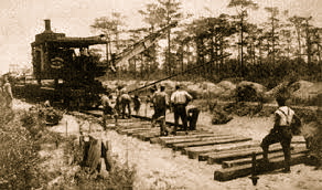 Railroad crew working across the marshland.
To get from South Scituate (Greenbush) to Marshfield, a causeway had to be constructed across nearly one-and-a-half miles over the North River Marshland and a bridge was to be built across the North River… a tall order.
The bridge over the river became a thorn in the side of many Rivermen. It was low to the water and had to be disassembled for boat passage. Very poor planning by the Old Colony Railroad.
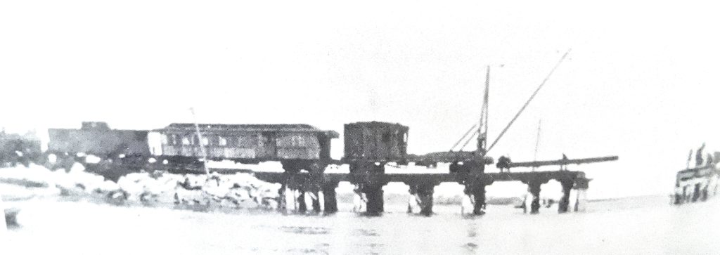 The Railroad’s crane at Damond’s Point c. 1910.
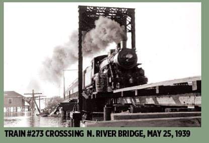
This was sent recently by a follower.
This train is heading south over the North River bridge.
The camp on the left is now the “Dauphtucket” camp.
One month later the Railroad from Green bush to Plymouth was discontinued.
Excerpts from “The Story Teller” of Damond’s Point;
“The bridge was not a draw, and when boat passage was demanded, a work train equipped with a crane had to be dispatched from Boston. The central section of the bridge was then taken apart, rails were unbolted and pulled up, cross-ties were removed and heavy timbers were unbolted and swung to the side. The process was reversed after the boat went through. It was entertaining to watch.”
“The bridge was replaced in 1910. The new one was about three feet higher and had a draw operated by manpower and a concrete counterbalance. The entire track across the marshes was raised about the same time the bridge went in. A side-track was built at Damond’s Point and track-men had temporary quarters in railroad cars there. It was entertaining to spend an evening with them.”
By Walter Crossley, Damonds Point.
Before the Railroad, Damond’s Point was about a ten-acre outpost for hunters and fishermen, very difficult to get to, and with a little shelter. After 1871, it didn’t take long for shorebird & duck hunters to arrive by train early in the morning and return home after dark.
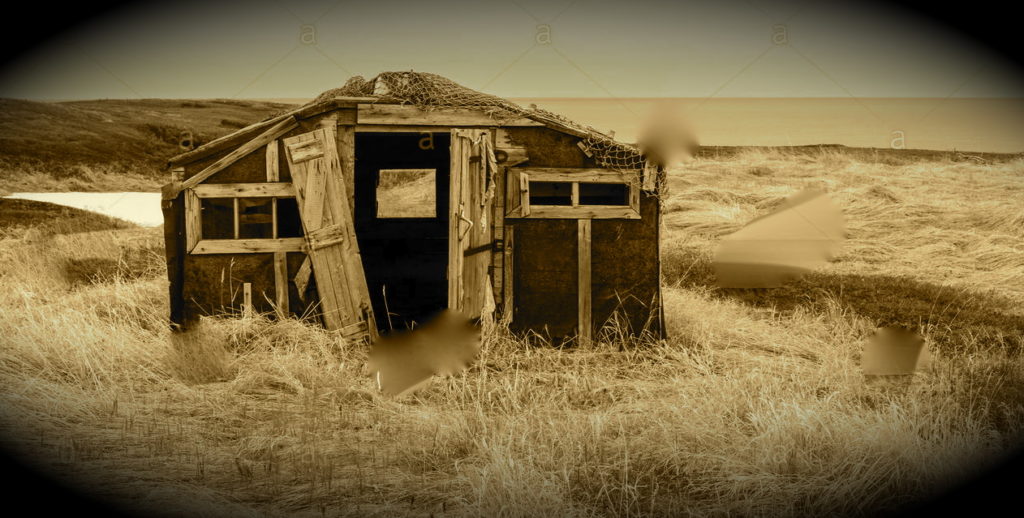 Shacks like this provided cover for hunters & clammers in the 1800’s.
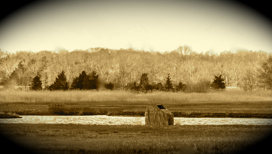 Shorebird and duck hunters built blinds along the banks of the North River.
Another quote by Walter Crossley;
“In the course of digging [Walter & friends were clamming] a bottle appeared from the mud. Investigation showed it to be full and the seal still intact. The most venturesome of the party opened it, sampled it and pronounced it excellent.
The weather improved immensely from then on, the sun shone, the cold disappeared, and even the seagulls sang sweetly”.
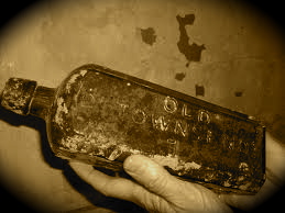 This is a bit “off the track”, but I thought humorous!
Getting to Damond’s Point by land was a chore. The cart path started on Summer St. just above 758 and was the right-of-way to the Point and other Islands.
Walter Crossley wrote the following;
“I have neglected to mention the old access road that was used for many years. It left Summer St. at the Phillips’ place at first passing the barn on the left, later changed to go between the barn and house, then a long lane with stone walls separating it from the orchard and hay fields. There were at one time five sets of bars, or in modern terms, sections of rail fence that had to be taken down and replaced at every passage to prevent cattle from escaping the pasture. As it reached the railroad a sharp left turn paralleled the track for some distance until the crossing was reached. Once across the tracks the road ran into the marsh, then turned left to the Point.”
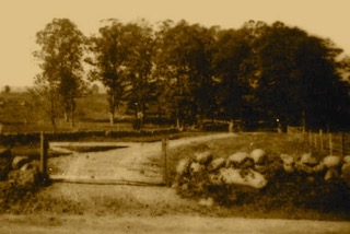 A Gated cart path off Summer St. was the only way to Damons Point prior to 1955.
I can attest to the cart path because I traveled it in 1954 in my car.
At that time there where only two gates, one on Summer St. and one near the tracks. Damond’s Point Rd. wasn’t constructed until about 1958.
Walter’s trip to get supplies at the village of Marshfield Hills consisted of a hike as described by him;
“Armed with market baskets, and grain sacks, if daylight permitted , a short -cut through the woods, crossed Summer St. and came out near Prospect St.
Coming home after dark it was necessary to come down from Prospect St. to Summer St. to the Railroad Station and then follow the tracks home.”
Walter Crossley & his wife Nora, were 60-year residents of Damond’s Point. His parents arrived in 1906 from Pembroke.
Walter wore many hats… a clammer, a fisherman, a hunter of upland-game ducks & shorebirds… a carpenter, a shop teacher, a whittler of various birds, and in the early 70’s, a writer. His articles were published in the Mariner newspaper.
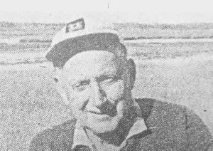 Walter with his beloved North River in the background. c. early 70’s
The next obstacle facing the building of the tracks was crossing the Beare’s and Hanna Eames Brooks, that joined at Summer and Prospect Streets. Then they ran easterly out to Macomber’s Creek and into the North River.
A great deal of fill was needed to cross that marshland. I suspect most of it came from South Scituate’s Coleman Hills.
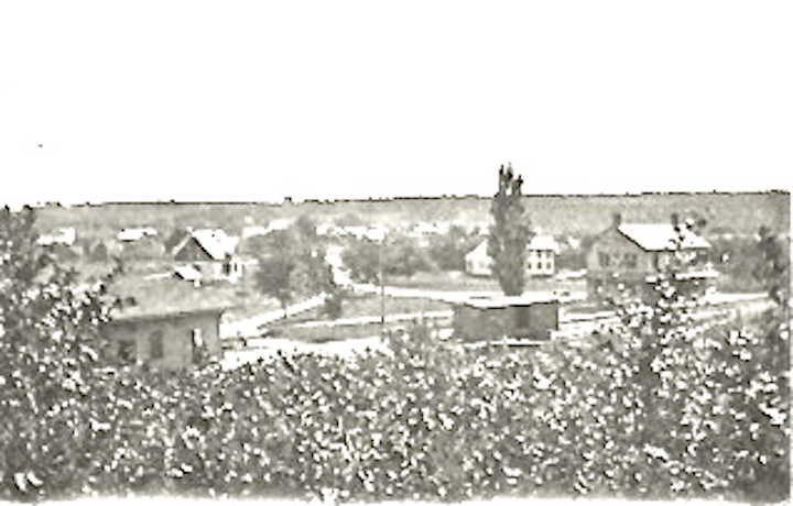
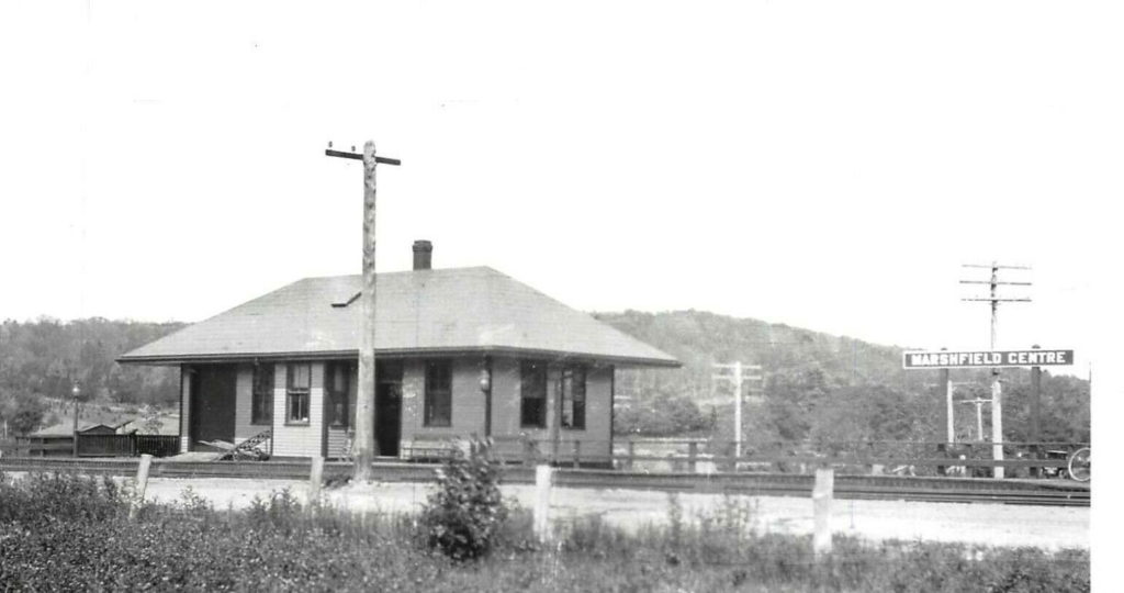
Next came the East Marshfield Railroad Station, changed to Marshfield Hills on Oct. 13, 1890.
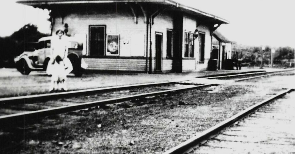 Looking NW, c. early 30’s
This was built on the north side of Macomber’s Way with a water tank on the south side of Macomber’s Way. A rather strange doing because there was a water tank just two miles north at the South Scituate Station.
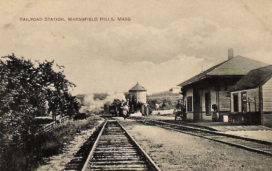
There was a great deal of expense to dam-up Rogers/Wales Pond and build nearly a mile of pipeline from Pleasant St. to Macomber’s Way.
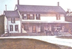
This Station did not have a freight house, although a privately-owned Lumber & Coal business was called the “Freight House”. This business was owned by a Mr. Lewis of South River St.
Years after the discontinued Railroad, the building was converted to a residence by Sherman Nicholson at 638 Summer St.
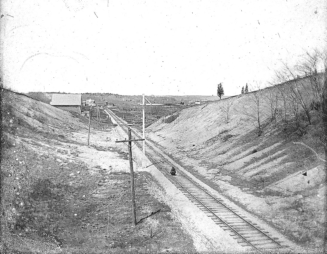
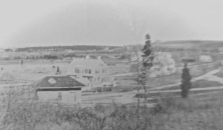
A cut was made between Flower Hill and the Embankment House at 530 Summer St. known as Trouant’s corner.
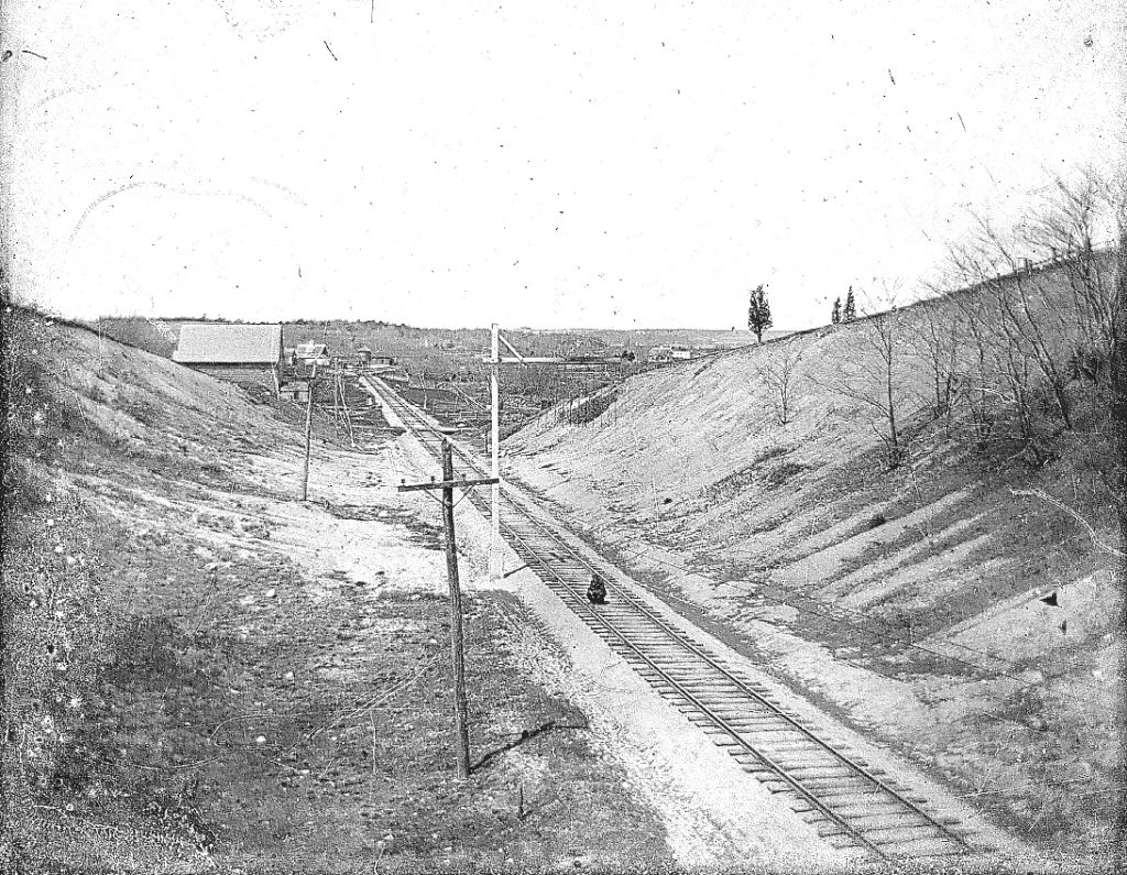
- Photo taken from the Summer St. Bridge. Right is the northwest side of Flower Hill. The Barn, left, is behind 550 Summer St. The Water Tank can be seen at the end of the tracks. c. 1910.
For those of you who know the area, Damond’s point Rd. didn’t appear until many years after the railroad was discontinued.
After passing through Damond’s Point, the Railroad was challenged by special groups wanting the line to be different from the Railroad’s plan.
One of these groups were East Marshfield (Marshfield Hills) residents. They wanted the line to pass through the valley just south of the Prospect St.. valley, then to cross Pleasant St., where a station would be built, then on to Main St., following Main St. to South Marshfield. That was discarded by the RR.
The next proposed layout was from Damond’s Point south, across Macomber’s Ridge Rd. at grade level, the site of the East Marshfield Station, then would run east of Flower Hill and across Little’s Hill, 272 Summer St.. That layout was also discarded.
A straighter route was from Macomber’s Ridge Rd., through Flower Hill at it’s northwest corner (as seen above). This was a straighter line and of a lesser grade. This would pass over Littletown Rd. (Summer St.), which is west of Flower Hill at grade, then to Pleasant St. at Little’s Hill, also at grade.
Dog Lane was once Pleasant St. which started/terminated across from Henry Little’s residence, later to become The Little Green Light at #272 Summer St.
Pleasant St. was re-routed about 150 yards to the northwest so that a bridge could be constructed for trains to pass over Pleasant St.
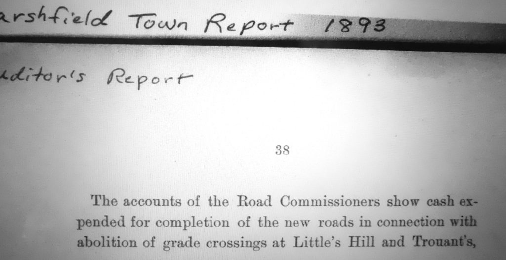
Another interesting fact listed in a 1893 town report is — ” the abolition of grade crossings at Little’s Hill, 272 Summer St.,and Trouant’s,” about where Flower Hill Lane intersects with Summer St.
 The last leg of Pleasant St. relocated, shown here, note the Railroad bridge framing a horse & wagon on Summer St.
I have used “at grade”. In 1870, the crossing of train and traffic were at the same height. There were NO BRIDGE crossings as they were not needed. The only traffic consisted of a few pedestrians and not many horse & wagons.
Ever since I can remember living in Seaview and across the street from a Railroad Station with steam trains rumbling through our village, I was captivated by those behemoths. However, it was short- lived for me as the trains were discontinued at the time of my early recall. I watched the tracks being removed to be used for WW II’s needs, and Stations disappear, as well as most of the right-of-way being overgrown.
I have known for a long time that the Cape Cod house at #35 Station St. was originally on the plot of land that the Railroad took by eminent domain prior to 1871, from Deborah Stevens, 1801-1892, wife of the late Oliver Stevens 1795-1844.
35 Station St. was moved from 53 Station St. to make room for the building of the Railroad Station. The large ell on the right side was used as a home- industry of shoe-making. The first floor contained the machinery and shoemakers. The second story were rooms for the workers to board in. This was known as Doane Stevens Shoe Mfg. Co.
This information was passed on to me by Deborah Doane Lambert.
A small Station, about half the size of the stations to the north and also to the south, was built on the northerly end of the plot, near Summer St., then known as the Littletown Rd. , and across from the Littletown School. In the early 1870’s there was little passenger use. There was some use by the shoe shops,and Randall Mfg. became a heavy -user receiving materials and shipping it’s products.
The farmers now found a much faster and cheaper way to get their produce to the Boston Market. The Macomber milk farm was a heavy user.
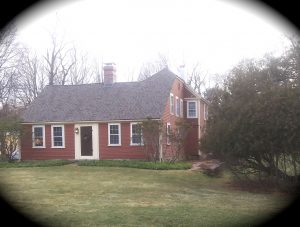
Looking Northwest from Holly Hill, the small hip-roof building, center, was the first Littletown/Sea View RR Station. This is the only photo that has surfaced as the 1870 Station. Photo before c. 1884. Compliments of Cindy Castro.
 Looking southeast from Dog Lane.
Left, the first Station now was referred to as the “Freight House”. The new two-story station is on the right, built c. 1884. Behind the cedar tree is the former Doane/ Stevens Shoe Factory. A box car sits on the westerly siding. Holly Hill is in the background void of trees.
 The first Station, left, the Thomas Stevens/Charles Langille residence, center. Behind the tree , the Alonzo Stevens residence, Station Master.
By the early 1880’s the Railroad found itself in a predicament, with the new bridge over the North River ( known as the Sea St. Bridge – 1881) from Sea View to Humarock and the Hotel Humarock. Pedestrian traffic increased tenfold. The passenger trains had to increase their three trips a day to eight a day during the summer.
Humarock beach was now in a building boom relying on the Railroad for the needed building supplies. Taxi services and freight wagon businesses sprang up in Sea View & Humarock much to the delight of the entrepreneurs .
The small Littletown Railroad station was a one-‘ room building with seating for only a few patrons, and no conveniences. There was an outcry for better services from the patrons, town officials, and the commercial businesses.
A large two- story building was erected in 1883-84 with a waiting- room for up to fifty people, including eight-foot waiting benches (settees) inside and outside under a canopy. Restrooms with running hot & cold water were added along with coal-fired pot-bellied stoves for heat.
A full-time Station Master with teletype communications was hired, and a kitchen and bedroom for the Station Master was added on the first floor. The second floor consisted of three bedrooms, a kitchen , a living-room, and a bathroom, all spacious enough for a family rental. The Station had an ell on the south side that housed a low voltage, direct-current generator that supplied power for the water pump and lighting.
The grounds were landscaped with bushes and flowers provided by the Railroad and maintained by the Station Master as well as volunteers There was much praise by the Town Fathers and an 1884 newspaper article, requested the other station to follow same. ( that never happened !)
An awning and piazza was added during construction to three sides—east, north and west. This building was about 25’x40′ and sat on a full granite foundation. A well was located on the northeast side.
The original station was left on site and was referred to as the Freight House. It is unlikely that much freight was stored due to it’s small size. It was more likely used as a storage shed for the Station equipment such as hand trucks, baggage carts, and tools which had to be stored. The Station did not have storage space in it.
 The new Sea View Railroad Station c. 1884.
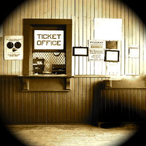
Inside the Ticket Office.
An observation of old Marshfield maps shows that Station St. was Summer St. before the Railroad. Summer St. was straightened about a hundred yards east.
In the original layout and construction of the Railroad tracks, there were no bridges. All the crossings were “at grade”,which meant the tracks and roads were at the same level. That makes sense because there were no autos traveling the streets until after 1900. The only bridges were over the North & South Rivers.
Granite blocks supported the bridges which came later as needed. The tracks then ran from Sea View southerly through the valley east
of Sea View Heights, then Seager’s Hill, now Deer Hill, and west of Little’s Creek.
This was a long section and heavily forested. And many fires were started in this area by the wood fired locomotives.
During my days of explorations in these woods there were burned- stump remains over much of the hill now called Carolina Hill.
The train had to pass the Centre Marshfield station and block off Ferry St. during it’s loading or off- loading. It was a well guarded “at grade” crossing Ferry St., at what we know as Pearl’s Corner.
The final crossings were at;
Macomber’s Way, at grade.
Summer St. behind #530, Auto- bridge over tracks.
Pleasant St., relocated northerly. Train-bridge over road.
Pleasant St. originally intersected at 272 Summer St., Little’s Hill.
Ferry St., at grade.
Clay Pit Rd., at grade.
South River St., Train Bridge over road.
Ocean St., at grade. A fatal accident of four auto passengers occurred here—-also a fatal accident of one occurred near Damond’s Point.
Parsonage St. Auto- bridge over tracks.
Careswell St. at grade.
There were nine crossings, more than any other South Shore town.
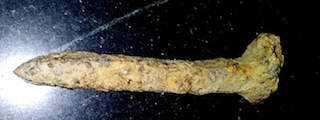 A recent find in Seaview…. a railroad track spike. this has been buried for 78 years.
I remember, during WW ll, scrapers would comb the recently removed track bed for spikes, plates, and any left behind metal to sell to the scrap dealer.
W. Ray Freden, Sea View/ Marshfield 70 years
Cool story!
Great to learn about this part of Marshfield.
Thanks for wonderful trip down memory lane. During 40’s and 50’s our home was on West side of Summer St, at about #600….It would be interesting to see a map of where those tracks went as the line went down Summer St throught Seaview and on to ????(Where & why??)
Did a hurricane damage the bridge at the North River? When was the last time a train crossed at Damon’s point? Thanks