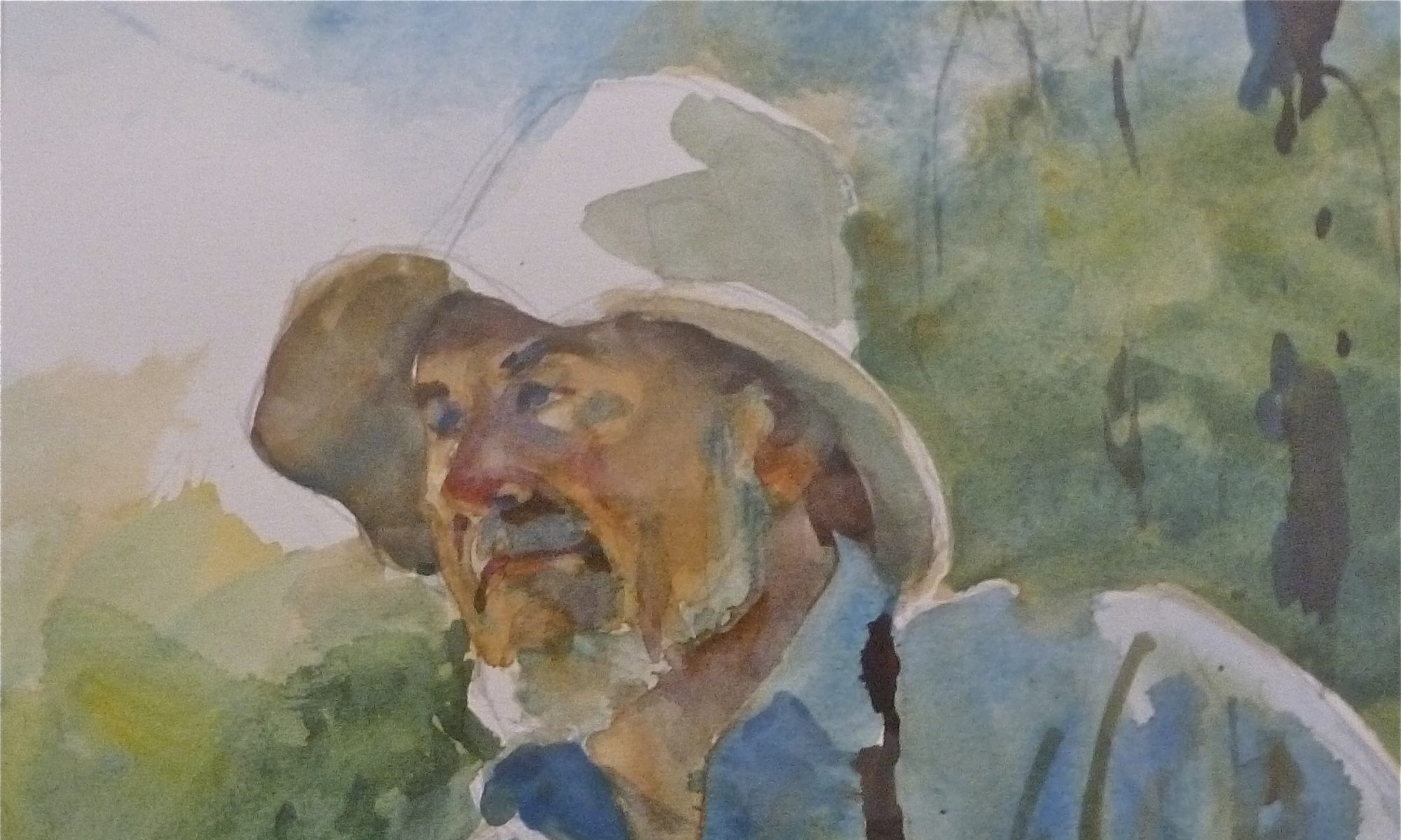
SALT MARSH GRASSES — AKA SALT MARSH HAY
Salt marsh grasses, also known as salt marsh hay, were an important commodity in the Old World. The earliest documented record of thatched roofing in the UK dates back to 700 AD, although some suggest it may have been used much earlier.
EARLY HAYING ON THE SALT MARSH
This was a family affair.
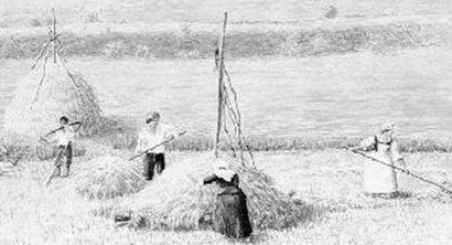
There were many other uses for marsh grass, and the New World settlers were quick to make use of the abundance that surrounded them. Another of Mother Nature’s essential resources, free for the taking.
Thatching being installed on an early cabin roof.
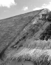
One of the settlers’ greatest needs was material for thatched roofs on their new cabins. These roofs required special layering of bundled, long grass, tied and stacked in rows to provide protection from the sun, rain, and weather.
Native Americans living near salt water and tidal rivers made use of many plants, including a wide variety of bulrushes and sweetgrass. Early settlers commonly used timothy grass and clover as hay, as these were among the most prevalent plants available for fodder.
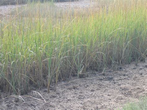
To obtain this valuable commodity, settlers needed access to many acres of marshland—a difficult task. There must have been a great deal of trial and error in developing walkways, followed by crude roadways. This type of construction might be fine for a man, but for a beast it was questionable. Oxen and wagons were another matter entirely. A wide, stable surface was needed to support both the animals and the wagon.
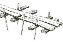
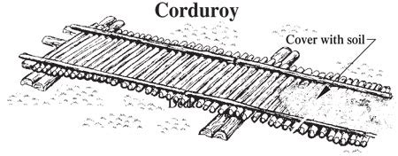
Corduroy roads are among the earliest types of manufactured roads. They were made by laying logs across swampy, unstable areas, perpendicular to the direction of travel.
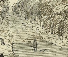
This sketch depicts a corduroy road through a swampy forest.
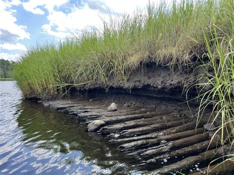
The landing visible on the North River in Norwell was the termination point, at the river’s edge, for such a road. It is not the road itself.
At this point, a barge could be secured to the landing, creating a stable loading area. This lower level also made loading easier. There would be much less lifting required to top off a full load of hay.
There was a vast amount of salt hay in this area, making travel across the marsh necessary. One major advantage was an island located between the mainland and the river. This meant that less corduroy road was needed to reach the river.
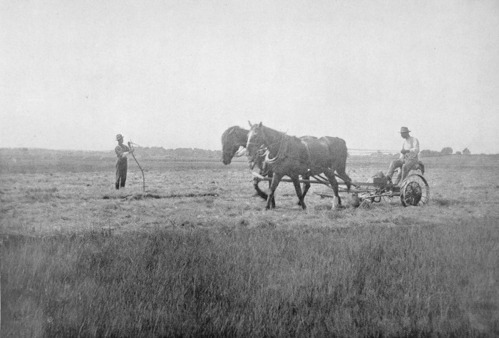
A team drawing a cutter bar, mowing the long grass.
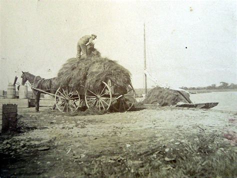
A wagon being unloaded into a small barge.
The island may also have been an intersection for a larger network of roads. I often wonder whether this was one man’s undertaking, or whether neighboring landowners were involved as part of a business venture serving the farmers along Norwell’s River Street.
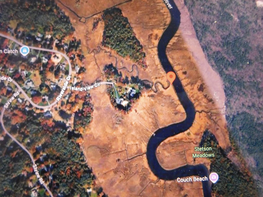
The balloon marker, center right, shows the location of the wood-pole landing on the North River in Norwell, Massachusetts.
Some grasses provided food and bedding for cattle. Other reeds could be twisted and woven to cover chair seats. Mats were woven for sleeping, providing insulation for both people and animals. Clay potters and other home industries also used salt hay for packing fragile items.
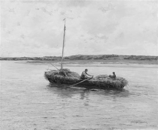
Demand for marsh hay became so great that it was cut and shipped by wagon and river barges. River barges came in many sizes, ranging from one-man boats to vessels operated by two to four rowers or polers.
Poling, rowing, and sometimes sails provided propulsion. The method used depended largely on the type of waterway.
From a one-man dory fully loaded to a barge carrying a small load.
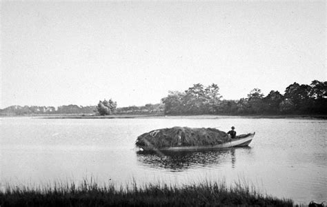
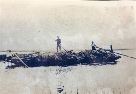
Here we are looking at transportation on the tidal North River.
River transportation was considerably less expensive than traveling overland. The river itself was free, while overland travelers might encounter tolls, as was the case here.
There has been considerable controversy over how the logs used in the riverbank structure were placed. Some believe they were driven into the ground. My sources and I believe instead that a ditch was dug, the logs were laid into it, and then covered back over. This would have been a much faster method than driving them in, which would have been extremely difficult in the early 1800s.
A great deal of calculation would have been required when determining the structure’s height in relation to the river, particularly for loading convenience.
Loading a barge also had to follow a strict timetable. An empty barge needed to be brought into place as the incoming tide permitted and secured promptly because of the rising water.
Loading could then take place from waiting wagons or from haycocks positioned nearby ahead of time. The work had to be completed quickly so the loaded barge could meet planned deliveries to customers both upriver and downriver.
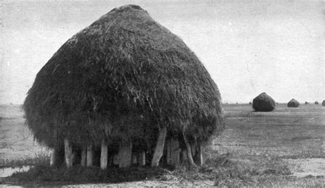
A haycock awaiting loading. The piling foundation keeps the hay dry.
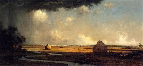
Martin Johnson Heade’s painting of haycocks on the South River.
Shipping across the river, either upstream or downstream, saved a long overland trip by oxen and wagon.
An upriver trip was generally easier. Once the barge was loaded and floating, the crew could cast off and pole with the current as far as the high tide would carry them, or until reaching their destination.
A downriver trip was a different story. The barge had to be unsecured and poled away while it was afloat, leaving only a narrow window of opportunity during the fast outgoing tide. The crew then had to reach the delivery landing while there was still sufficient water. Missing that opportunity meant waiting for deep water before trying again.
As mentioned earlier, the barges came in many shapes and sizes. Some were as long as 40 feet and carried two tons or more. They included flat-bottomed craft, shallow-hulled, double-ended dories, and small rowboats, depending on the size of the waterman’s business.
The North River was very busy. Shipbuilding continued there into the early 1870s, alongside fishing boats and transport vessels. For the early settlers, this was a heavily traveled working river.
THEN CAME DISASTER!
The Great Storm of 1898, also known as the Portland Gale, struck the New England coast on November 26 and 27. The storm caused more than 400 fatalities and sank more than 150 boats and ships. It brought hurricane-force winds and a storm surge of roughly ten feet above normal, severely affecting many coastal communities.
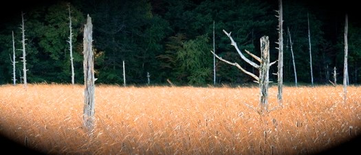
This great storm created a breakthrough of a new inlet between Third Cliff and Fourth Cliff, allowing salt water to extend farther into the upper marshes. This killed salt-sensitive vegetation, from grasses to stately white cedars, white pines, sugar maples, and many other species.
The storm devastated the salt hay business and the industries associated with it.
Corduroy roads became submerged, covered over, and eventually lost. With the decline of the salt hay business, they were no longer needed.
Many, many years after the Portland Gale, the remains of the white cedars still stand, never to recover. The tender cordgrass, along with many other plants, has been replaced by invasive cattails.
Compliments of Mike Sleeper.
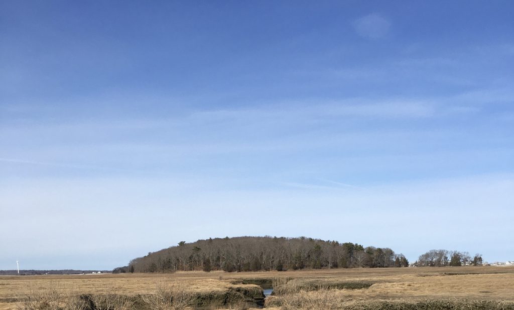
The only corduroy road I remember was the road to Tilden’s Island, also known as Hen Island, in the South River marsh.
It ran from the east side of Flower Hill, off Summer Street, by way of Hen Island Cart Path. As a youngster, I walked the dilapidated remains across the marsh—a reminder of the earlier days.
Tilden’s, AKA Hen Island, today, looking easterly from Flower Hill.
W Ray Freden, Seaview, Marshfield, 70 years.
Down East Maine. “The Way Life Should Be”
Further Reading
As I Remember Decker Hatch, Part 3: Decker Was a Hard Worker
rker