Hatch’s Hill, Governor’s Hill aka Holly Hill Part 2.

After you have read part one of this great hill, we are ready to explore the perimeter.  Starting at the intersection of Summer, Elm, and Church Streets, heading south, there were no homes on the steep western side. The only residence was the Tilden Ames Farm at 44 Church St., built in 1855.
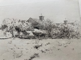
                                                      OAK HILL FARM

                Artist unknown. Compliments of Robert Davis to Marshfield’s Town of Villages.
Tilden came from a long line of Eame’s/ Ames’, from as far back as 1650-ish. Tilden’s Dad resided in Sea View.  Tilly and his wife, Willena, ran this farm ( Oak Hill Farm)  until their deaths.  Willena died in 1952 & Tilly in 1954 at age 84.
Their grazing land ran from Church St. to the Railroad tracks on the western side

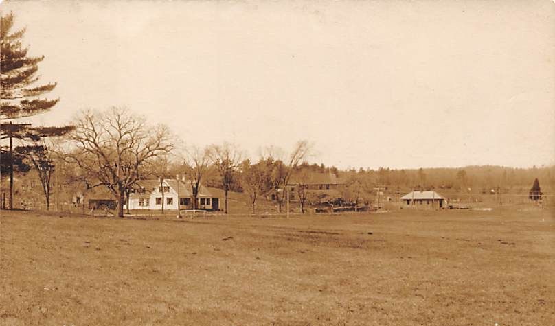
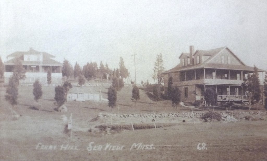
     Left:  #520 Ferry St.  (1850).  Right:   Centre Marshfield Railroad Station.

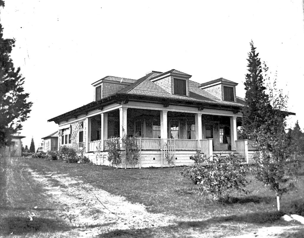
Their farm consisted of a roomy farm-house, a three-story barn and a number of outbuildings. They raised cattle, pigs, and chickens, which were sold fresh off the farm.  In their latter years their son Robert Ames, and their daughter, Bessie Bell,  helped run the farm.  Robert left the farm to start a business that was once known as Marshfield Sand and Gravel.  Bessie married Robert Davis and downsized the farm.  Bessie became well known as a cook in Marshfield High’s Cafe.

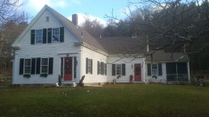
The former (Oak Hill Farm )….44 Church St. today.


We leave Church St. at Ferry St. and head east with Holly Hill on our left, north- side.  Then another long stretch being void of houses or farms.  However, the right side was a different story.  That was/is Telegraph Hill…..another story.
The intersection of Ferry St. and South River St., on the south side of Ferry St, & east side of South River St.,  was the Ferry School , serving mostly Centre Marshfield’s children. It closed in 1917 due to a small attendance. The building was moved to Ocean St. and finally razed.

Traveling over the hill on the left was the R. Lewis farm, (the Sojberg’s Antique Shop)  # 891.  I have found little information of this operation.

Looking north,    WILLIAMSON’S BARN in center.

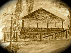
Next, was the Walnut Grove Farm. which had a huge barn, along with a large farm house.  The Williamson name goes back to 1642 when Timothy Williamson settled on the South River near the Otter Bridge (the Willow St. Bridge), and built the Ordinary at 2000 Ocean St. consisting of an Inn and store.  Charles Williamson ran the Walnut Grove Farm and it’s 120 acres of crop land, mostly on the river-side of Ferry St.  He grew strawberries and raspberries, along with many other fruit trees.

Williamsons Farm House,    Ferry St.   next to #891.

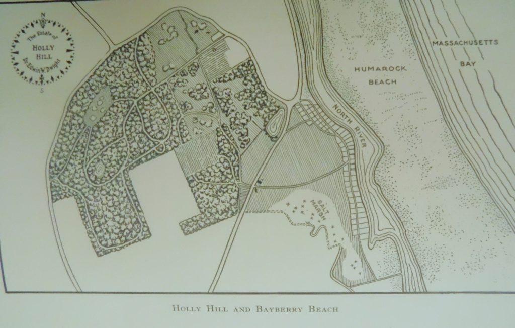
The farm commanded the southeast side of Holly Hill.  Much of the Williamson land was bought up by Gov. Emery and followed by Edwin Dwight.  A great deal of spring water ran off this side of the hill providing  water for cattle and to irrigate the crops. The Bayberry Shore consisted of cultivated crops to the now Ridge Rd.  Salt hay was  harvested throughout the area also.
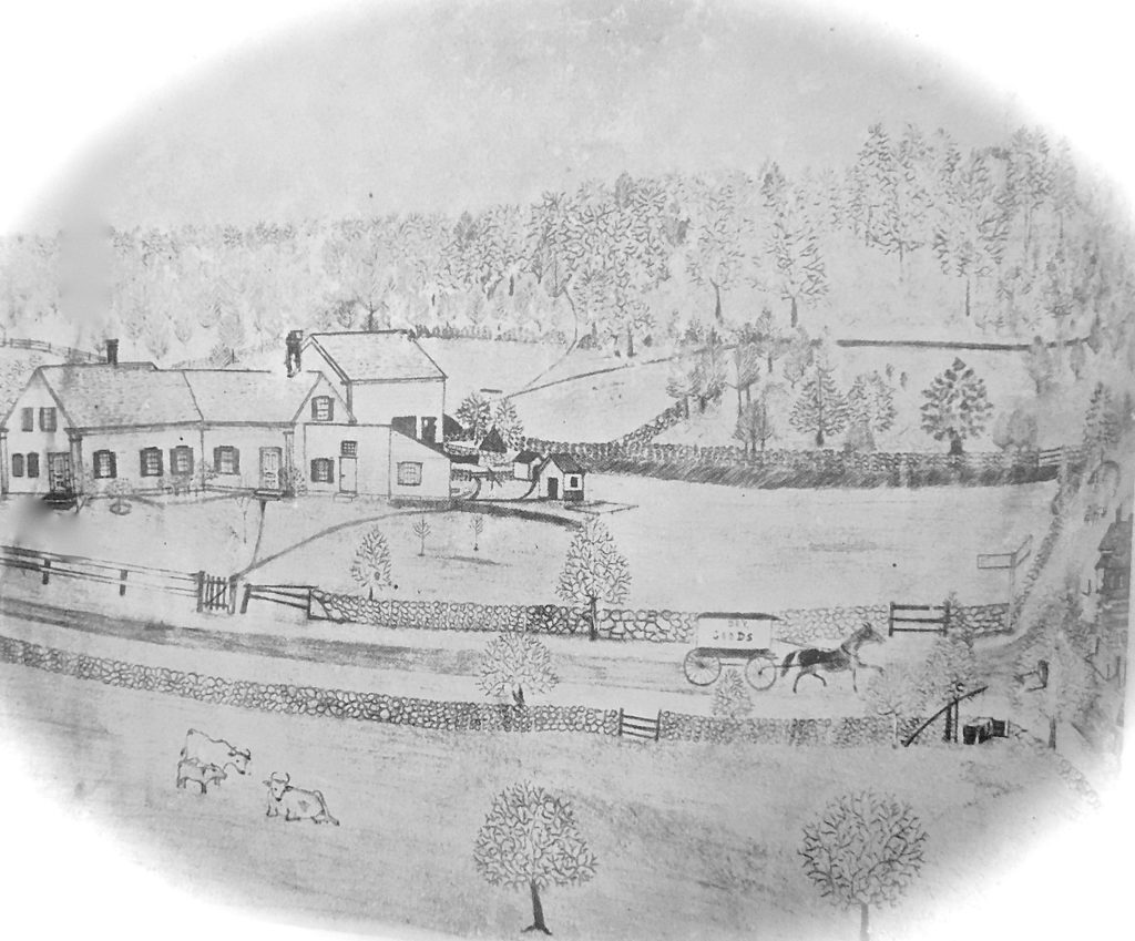
                          A pencil sketch of the Williamson Barn, c. 1912.
After over one hundred and fifty years, two of the original farm residences still stand on Holly Hill in spite of the bulldozer.
In Gov. Emery’s time, there were no formal roads through the hill.  Cart paths were established to serve the needs of farming. The driveway to the Governor’s farm remains today as Christmas Tree Lane.  Another early driveway, now the east-leg of Holly Rd.,  served an 1852 farm house… possibly one of the four residences noted as being part of the Emery Estate.

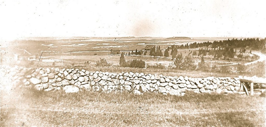
No doubt the oldest house on the hill is 165 Elm St.,  just north of Holly Rd….. a Cape Cod style home built in 1728.  There was another old home up the hill and behind #165, but I find no record of it.    Across from Ferry Hill Rd, on the northeast corner, was  Littletown’s Town Pound…a stone-walled impoundment for wayward farm animals.

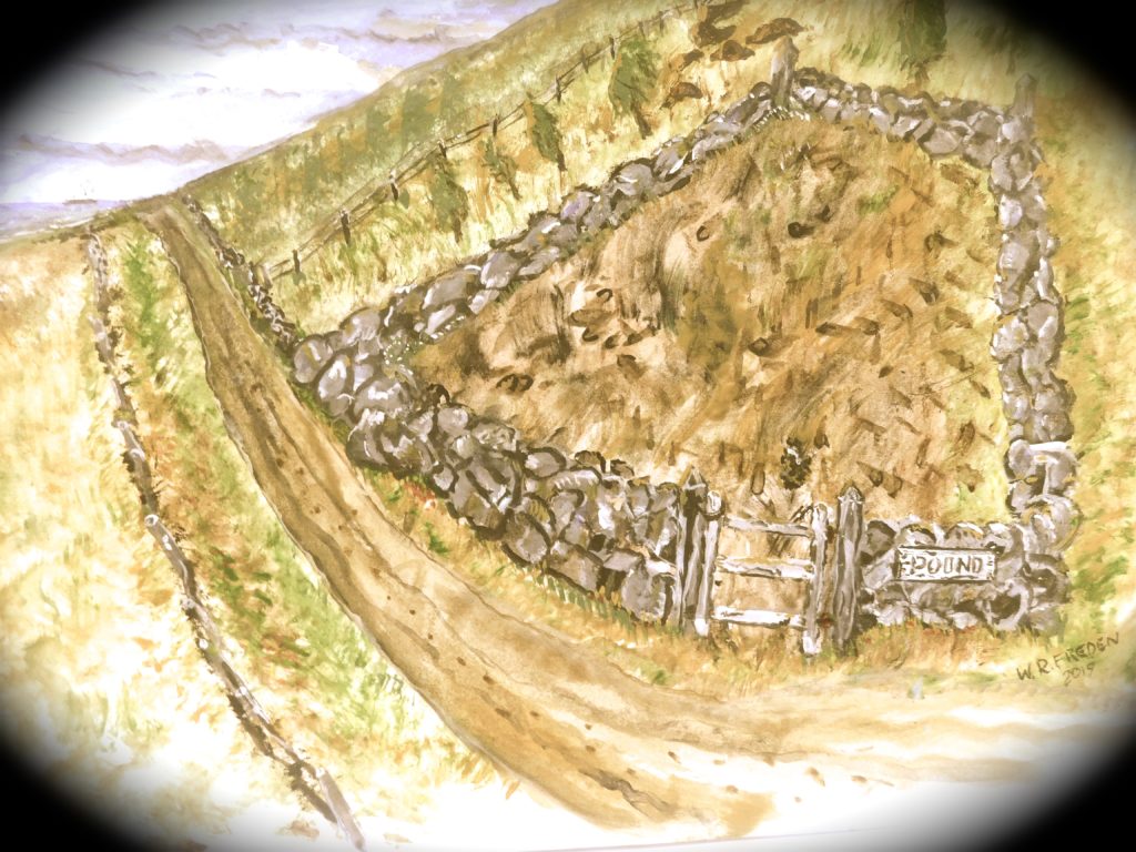
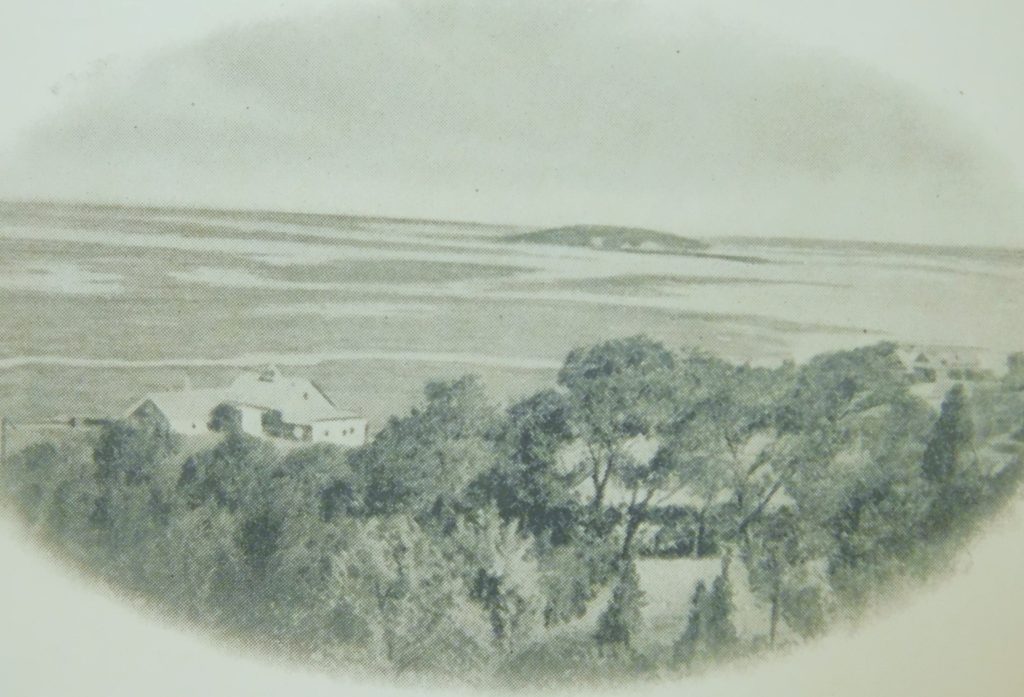
Painting by W. R. Freden
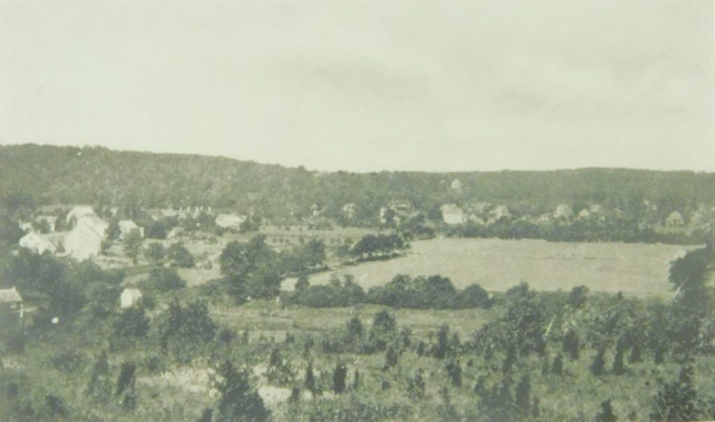
The north and northwest side of the hill was void of structures due to it’s steepness and lack of a long-day of sunlight.  Most of the early homes were built with their front bedrooms toward the long eastern and southeastern sunlight to warm those rooms.
After the ownership of Dr. Edwin Dwight and his residential building quest, access roads were needed. The first  through roads were Upland, on the north side from Elm to Elm….Dwight, from Upland , over the hill to Elm & Sea Sts… Emery, from Upland south to Dwight.  The two oldest homes on Upland Rd. were built in 1922 and 1929 during the Dwight era. These two hold a view of the South River marshes, Islands, Fourth Cliff, the Lawson Tower in Scituate and, on a good day,  Boston’s City outline. Two houses on Dwight were built in 1930, and on Emery in 1931, 1940 & 1941.
Other observations are during the Emery holdings.  He built a large barn   directly behind the mansion about 1/4 mile, where 151 Dwight Rd. is today.

One has to look close to see the barn as well as the mansion.  Just right of top center is the Gov. Emery mansion….to the far right is his barn for cattle. This was located at the now 151 Dwight Rd.    Other information in this photo, bottom left, is the original Littletown/Sea View Railroad Station The new 1883-84 Station is behind the trees on the right.  Station & Summer Sts. run through the center.

The owner of 151 Dwight Rd. reports that he continues to unveil rusty nails, spikes and other hardware while digging in his garden.
There was a rumor that a hotel was once built on the Hill, but no evidence of that has ever been found.
Between the mansion and barn, there was a wide-open grazing field, and on occasion a small plane would land there.
The Boston Globe published a news report that a small craft crash-landed without serious injuries or serious damage.
On the northeast corner of the hill was a pond where Elm St. meets Ferry St. This was a spring-fed low corner of land that collected water from springs in the upland.  It was only two or three feet deep, but provided wintertime ice skating. In my time we called it Polly’s Pond.
I did skate there with my school friend who lived across Elm St.

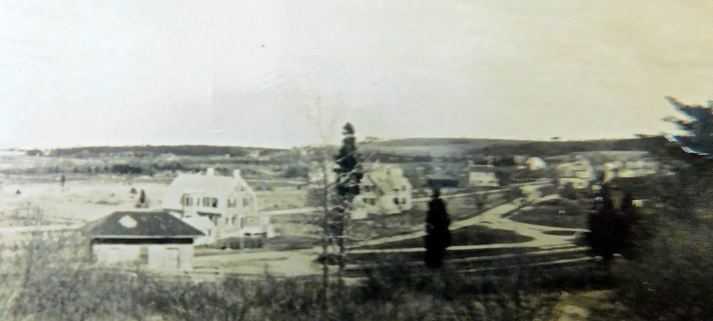
                                    Photo, compliments of Lisa Allen

Holly Hill did it’s part serving in WW ll.  A water tower was built on about #151 Dwight Rd. The Tower was contained by a chain-link fence ten feet high.  A personal building and a large generator was also within the enclosure.  During the war, Dwight Rd. was barricaded to traffic at Upland & Dwight on the north side. On the south side at Emery & Dwight, there were no residences within that close-off.  This made the “water” tower a very important structure.

Fire Tower, Radar, Dwight Rd. Holly Hill.

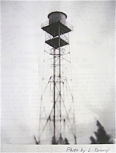
Well, that was no water tower!  It contained radar equipment that sent information to the heavy gun emplacement on Fourth Cliff.  A multi-wired cable was used to send that information. The cable ran across Dwight to the upper Holly Rd., down to Elm St, over to Ireland Rd. and then north along the river to the Military Base.  On occasion, during road-work, a section of cable will be found  causing amazement and wonderment.
Oh yes, what 12 year-old country boy would not climb that tower?  My Holly Hill friend and I made three trips to the top!  A bit scary because it was a long way up, but the view was something I had never seen in my young life.   Fourth Cliff’s Military History: <https://fourthcliff.co/fourth%20cliff%20history.html>

Holly Hill, Seaview, Marshfield, Massachusetts.  A special place in the Village of Seaview’s history.
W Ray Freden, Seaview, Marshfield, Ma. 70 years.

HATCH”S HILL, GOVERNOR’S HILL,aka, HOLLY HILL.


PART  1        The Mansion on Holly Hill, Seaview, Marshfield MA.

Over 500 acres of hill, 150 feet high, that commands a view of 180 degrees  overlooking Massachusetts Bay, from Rockport  to Provincetown, to Plymouth’s White Cliffs.
Holly Hill, looking north to Fourth Cliff.

The First Hatch to arrive in the area (1767) was Captain Noah Hatch.  Along with his brother, they owned a packet ship, “The North River.”  The Hatch’s delivered goods from Boston to the White’s Ferry area and supplied Hatch’s Store in Littletown, as well as others. They acquired a large amount of land on this hill, hence “Hatch’s Hill.”  Noah’s family married into the established Keene family that lived in the same area. The intersection of the Littletown Rd., (Summer St) and the Ferry Rd., ( Elm St), and Church St, was known as Hatch’s Corner, now known as Keene’s Corner.
Hatch’s Hill was covered with first-growth trees of many species. The tall straight White Pines were first to go into the masts of the ships built on the North River.  By 1800 the Hill was as bald as a billiard ball.

Holly Hill void of trees.

Hatch’s Hill became grazing land for cattle being raised by the farms built around it’s perimeter.

A lawyer from Maine, George Emery, married  into the famous ship-building Hall family.  The Hall’s now owned most of Hatch’s Hill.  In 1885, George  and his bride, Marcia Hall,  built a mansion on the east side of the Hatch Hill.   It soon became known as Governor’s Hill.
George Emery was born in Corinth, Maine, became a lawyer and was involved in politics in Medford, Mass. and Washington D.C.
President Ulysses S. Grant appointed George as Governor of Utah in 1875.
After George retired, he returned to Sea View and  became  involved in town politics and was president of the Marshfield Fair, along with other ventures. During his residency, he inherited and acquired 475 acres of land on this hill.
His estate included a  mansion (George and Marcia’s residence), 4 houses, a number of outbuildings, a butcher shop,  a windmill tower, 3 carriages,  6 horses, 10 cows, along with other farm animals.  Half of the eastern side was grazing land. North of his residence, he planted  a huge garden of exotic trees and plants that he called Holly Grove.  He and his wife enjoyed nearly a quarter- century of the good life on his hill.
Marcia died in 1898….George died a  very rich man in 1909.


George’s son lived in the mansion briefly after his father’s death.

Dr. Edwin Dwight, from Auburndale Ma., purchased the mansion and much of the land around 1922.  The Doctor had no interest in farming.  He was interested in developing the property into house lots. He teamed up with Robert Boles, a licensed broker as well as a businessman and politician.  Bob held the office of selectman in Marshfield.

Unknown to the Doctor, he was in for hard times, The Great Depression of 1929,  slammed  into the country.
Rich men became poor men overnight!  With the folding of the banks, many manufacturers went out of business, and building homes screeched to a halt. Dr.  Edwin Dwight and his partner Robert Boles had invested heavily into a large housing development on Holly Hill and Bayberry Beach.

This booklet published by Dwight and Boles,  describes the area and their offerings. c. 1920.


Upper left is Summer St., lower left is Church St., right center is Ferry St..
This site plan never happened.


A view looking northwest over the Thomas Little’s Grant on Summer St., now Cedar Acres.

Plans of one of their offerings.
This booklet contains 18 pages of Holly Hill and Bayberry Shores offerings .

Robert Boles survived the depression and opened a boat-building company in the former Humarock Ballroom on Ferry St., as well as his Real Estate business.

The Hall, Emery, Dwight  mansion, remained  vacant for a number of years.  The next residents were the Edwin Parker family.  He was a successful real estate investor. At the time of his obtaining this property, it had diminished to only a few acres surrounding the mansion. There is little information of his brief ownership.
My observations of the Parkers:
The first I remember of  the Parker’s  was  1940,  my first grade.   A black Packard limo would pass by as I waited for the school bus to the North School.
In the chauffeur-driven limo were 3 girls being transported to private schools in Hingham.   A wave from me got a return wave, but that’s the closest I ever got to knowing them.   In the following  summer, a sleek English car would occasionally race up Summer St.  I never knew where it came from until one Sunday I was hanging out on the porch at my uncle’s store in Humarock.  Up came the Jaguar SS 100 convertible sporting Mr. Parker, along with one of his daughters.  A quick In and out of the store and away they went.
Some time later, in 1947 or 48, I was visiting my friend on Emery Rd. and he told me that the mansion was abandoned.  He said his older brother was inside it and said that the owners just walked away from it….leaving everything.  Well, hearing that, Dave and I thought that was too much to ignore,  So, Dave & I  wandered  a short distance from his house down the hill.  And, oh my, the grounds had been ignored for quite some time and were quite overgrown.  As we walked around, I noticed how it needed paint and repairs everywhere. We peeked into the windows as best we could.  All the lower-floor windows were covered by drapes.  After a full-circle we decided we had trespassed enough.    My next visit was the following summer, with three classmates. We bicycled from Humarock, up the steep road to the mansion.  Upon arrival,  we peeked in the now-uncovered  windows.  It had been ransacked, although still full of furniture and other belongings.  We sat on the giant granite front step, just passing time, and the girls started singing “Cruising Down The River”.  They were inspired by looking down the South River…not far away.  I didn’t know many of the words, but sang along  as best I could. The girls, Phyllis & Barbara, knew all the words.

I have not found a good close-up photo of this once beautiful home.

“Cruising down the River on a Sunday afternoon…. With one you love, the sun above, waiting for the moon….. The old accordion playing a sentimental tune”……..and so on……

That was the last I saw of the mansion up close, and I haven’t found a thread of information of the last family to reside in the Hall/Emery/ Parker mansion.  It was razed the next year and a new home was built on the site.

NEXT……. PART 2,  A TOUR AROUND HOLLY HILL IN THE OLDEN DAYS….

FARMS
TOWN POUND
OLD HOMES
A LANDING STRIP

W.Ray Freden.

FERRY HILL’S EARLY DAYS

In the 1600’s an area called The New Marsh, later known as East Marshfield, was the entire northeast section, from Doggetts Ferry (Main St., Little’s Bridge) to the North & South Rivers’ mouth at Rexhame .   As the North River ran in  a northerly direction, a 70-acre, 70-foot high hill dominated the western bank of the river.  In  1638 a ferry-crossing was ordered by the Plymouth Colony Court on this hill’s eastern shore.
From top to bottom, Between Broad Creek and Little’s Creek,  a staging/mooring area for awaiting ships, was Pincin’s Bank. Then Rogers Wharf, the Ferry’s home, with a landing across the river to the Hummock’s. Next, J. Sherman, #1308, Ferry St. still exists. T. Rogers, Shipbuilder, no longer exists. L. Hall, the North River House, no longer exists.  W. Hall, site of the Bridgwaye Inn, next was Hall’s Shipyard and Wharf, & Blacksmith Shop. The unmarked Wharf was The Keene’s Yard, at the junction of The Ferry Rd. & Elm St.
This hill became known as  Ferry Hill, and the point where the Pilgrim Trail crossed the North River via a hand poled Ferry barge.
The Ferry Hill was covered with first growth trees…. White Pine, White and Red Oak, Chestnut, Black Walnut, Holly,  Elm, and Red  and  Sugar Maples, along with other species. Rose hips & beach plums covered the shoreline.
It was void of buildings until the early 1700’s.

Looking northwest from the Hummocks (Humarock) to Ferry Hill.
Roger’s Shipyard became the terminus and landing for the Ferry. This was beyond #1445 Ferry St. today.  Ferry hill was bordered by Elm St on it’s western border and The Ferry Rd. to the east & south.  No Sea St. until 1881-82.

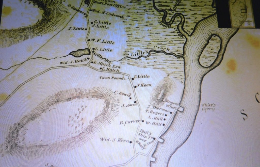
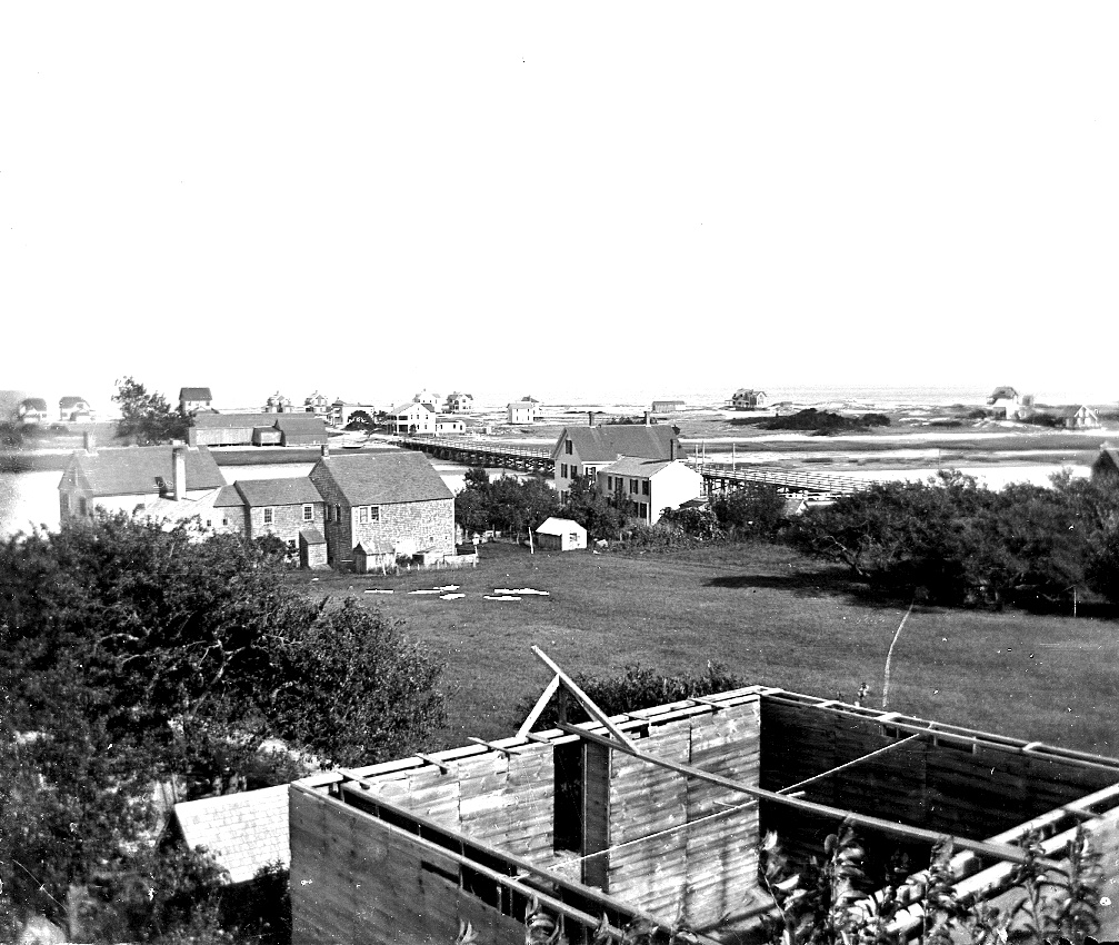
                                      The Roger’s Wharf & Ferry Landing.

  Looking from Humarock,  northwest.  Left: William Hall residence,  now the site of the Bridgewaye Inn.  Center: the Luke Hall residence, The North River House.  Right: the Rogers Shipyard & Wharf. Also, the Ferry Landing.                     From Cynthia Hager Krusell’s book.

A fresh water stream ran parallel to Elm St, between Elm & the Ferry Hill.  At its high point, at Allerton Rd., it ran north to Little’s Creek where it became tidal.  It’s southern flow brought it into the marshland bordering Neptune Rd., and discharging across The Ferry Rd. into the river at the Hall’s Shipyard located on Capt. Day’s land.


A finished rigged Schooner leaving the Rogers Yard for it’s maiden voyage.

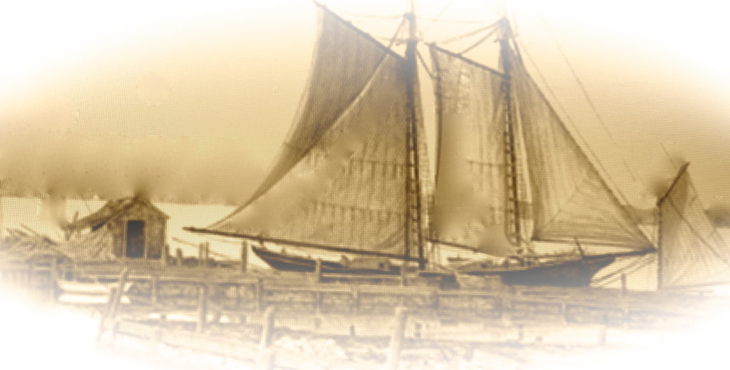
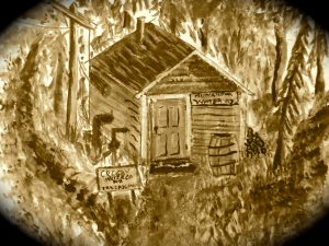
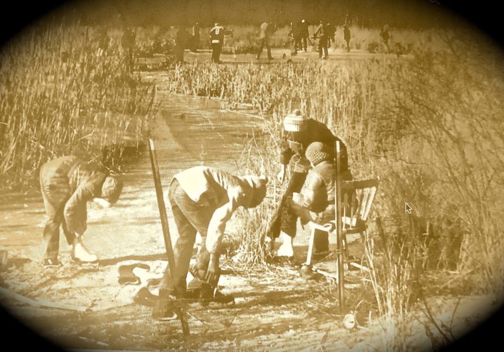
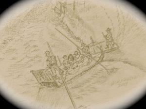
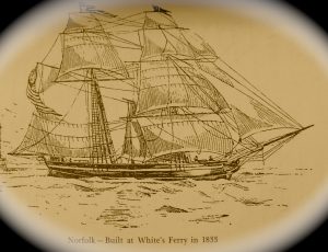
The “Norfolk”   Built at Whites Ferry.

The earliest record for a shipyard at the White’s Ferry area, was 1705.  This yard, Keene’s, harvested  timber from Ferry Hill, as well as Holly Hill, Carolina Hill and Centre Marshfield.  It didn’t take long to turn these areas into grazing land for cattle.

The North end of Ferry Hill was a shorebird and waterfowl mecca. Through the 1800’s a number of bird-hunting blinds could be found.

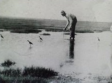
A shorebird hunter placing his decoys in Little’s Creek bordering the North of Ferry Hill.


These blinds overlooked Little’s Creek, the North River marshes, also Pine, Tilden,  and Trouants Islands, along with Fourth Cliff.  A dozen or two of decoys brought Yellowlegs, Whimbrels, Long Billed Curlews, Black-Bellied & Golden Plovers and Sanderlings by the hundreds. The local-market gunners could shoot from before sun-up to dark, harvesting hundreds of birds. Bushel boxes  and wood barrels were filled.  The local hunters kept very quiet about their favorite and bounty-full locations.
In 1871, the Railroad came to Marshfield. The first station in Marshfield  was East Marshfield,  followed by Littletown ( Sea View) and Centre Marshfield , all within a short trip to the North River shore. Rumors of great bird-hunting soon reached the city.  Affluent out-of-town  sportsmen gradually got wind of these hunting spots. Sea View was only an hour’s trip from Boston.  The local market hunters quickly turned to guiding these deep-pocket sportsmen.   They  picked the gunners up and after the hunt, returned them to the Sea View Railroad Station to catch the last train home with their bounty.

A horse &  wagon dropping off visitors & goods  at the Sea View Station

The local taverns, (Ye Surprise Inn), now (The Bridgewaye Inn)  and guest houses were also on the market-gunners’ list for a bushel or more of “Peeps” and ” Snipe”  to make a stew or pie for their guests.

Blinds were forced to move & began to lessen.  In 1918, a law was put on shorebirds  and waterfowl hunting which became controlled. Shorebirds were illegal to hunt and waterfowl now had designated seasons with a kill limit.

Looking northeast, overlooking the “New Marsh”.  Left, Victor Belanger’s cattle barn, Center, his boat house, George Ireland’s Club House, and Fourth Cliff in the distance.  On the right is Ferry Hill Rd, joining Grandview Ave.  Red Cedar trees now dominate the Hill… c.1860.

Looking S. with George Ireland’s  clubhouse (R.),  displacing a number of hunting blinds.

George Ireland , a businessman and land-developer, bought-up all the available land and laid out a plan of roads and lots in  1888.
Note; the bridge to Humarock was called the Ferry Bridge and built in 1881-82. The now Bridgewaye Inn was the Sea View House. The North River Beverage was the Josselyn’s stables. The remains of the Rogers Wharf  and Shipyard/ Whites Ferry  show here.  Shipyards and the building of sailing ships now disappeared  in the late 1800’s.  The last Ship built on the North River was 1871.

These small lots were geared for tents and camps for George Ireland’s city friends and cronies.  Summer weekends attracted droves of campers from  30 to 50 miles away.
An early 30’s camper

Mid 30’s.

Then came the platform tents.

Lunch time.

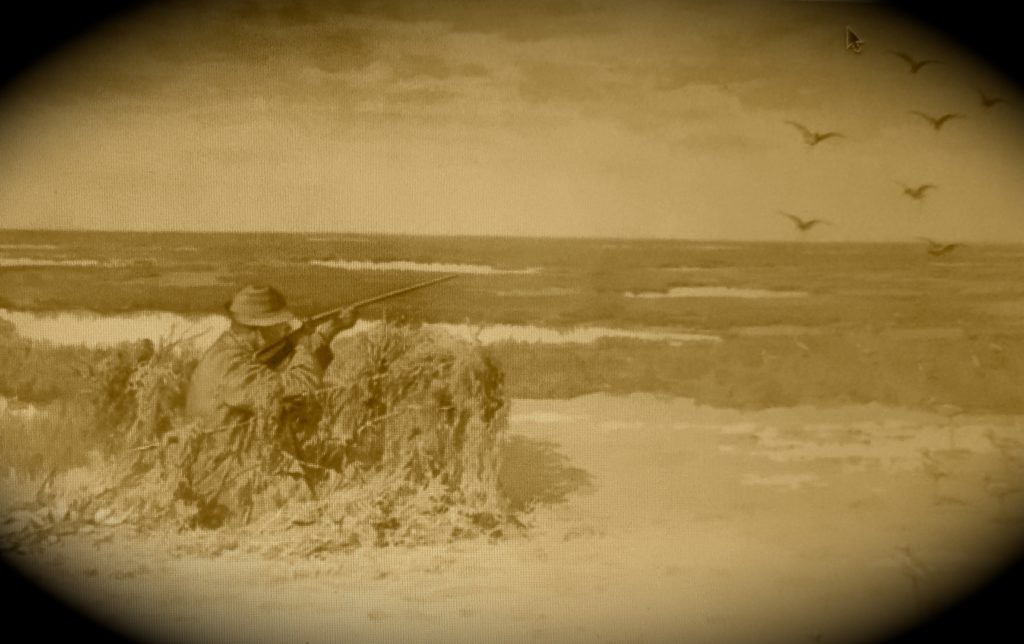
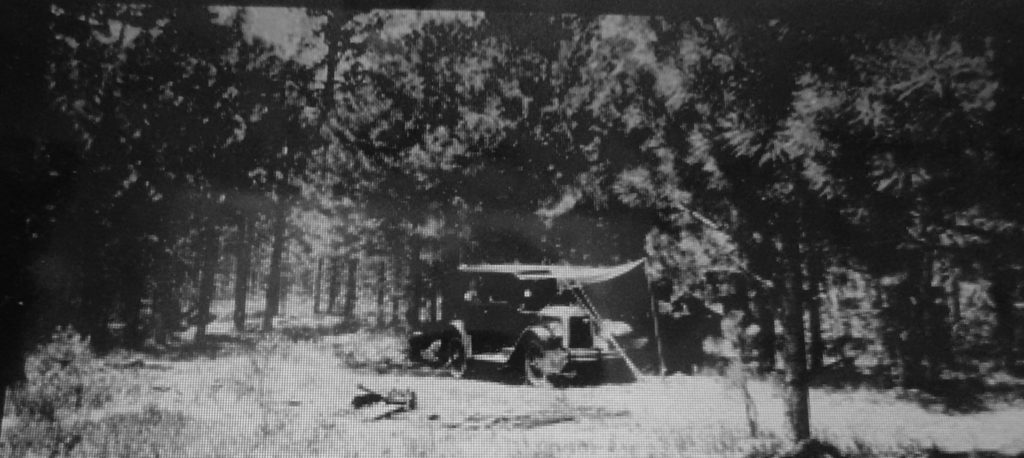
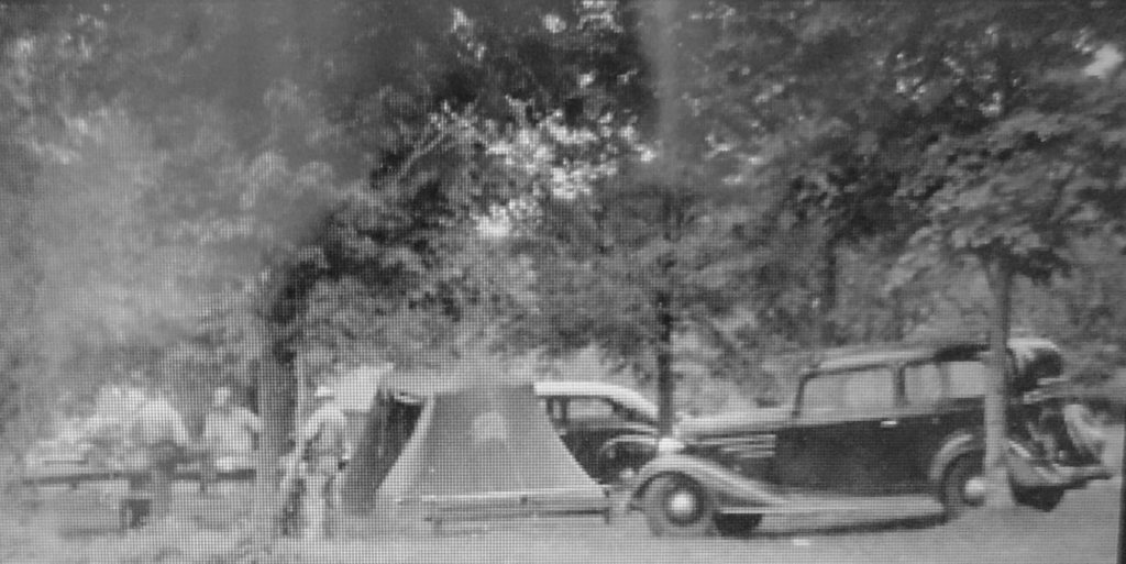
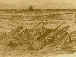
Early camps used cheap boarding from a local mill.


Followed by the popular novelty siding.

The Ferry Hill’s development was slowed down by the Great Depression with a short break of three years…..then stopped completely by WW ll for nearly 5 years.  It was then slow to get building materials.

In the mid-20’s the Crosby Water Co. built a pumping station and water storage tank on Ferry Hill.  Wells were established in the area, now known as The Thicket….a wetland  area with springs. This was developed to service Sea View  and  Humarock….the greatest demand coming from Humarock.  Public water suppliers were replacing outdated and contaminated private wells. Water lines were now found on most of the main roads in Marshfield.  By 1930 Ferry Hill was covered with a hundred homes or more.  Due to insufficient wastewater management, the wells became polluted and the Crosby
Water Co. shut down in 1946.

paintings by W. R. Freden.
Top: The water storage tank on Ireland Rd. opposite Carlton Rd.
Bottom:  The pumping house in the Thicket.


Just off Ireland Rd., an ice house was in construction to store ice for the demands of the Seaview Inn  (center), today’s Bridgwaye Inn.  c.1910, Left is the North River house.

Building-laws were creeping in and being enforced along with permits.
Tents disappeared, shacks were removed, building-lots became larger by adding adjoining-lots……allowing larger homes to be built.

A stately home at 51 Carlton Rd. Built in 1903.


The residents and shipyard workers watched history developing every day of the year for 200 plus years.  Over 1000 ships were rigged and outfitted with supplies and goods at the Whites Ferry Yards.
There are too many Ships to list here,  but the “Columbia”  was the first ship to circumnavigate the Globe and the “Beaver” was involved in the Boston Tea Party.
This little community of East Marshfield, Little Town, Sea View contributed to  history that has touched our entire country and beyond.
And today it is barely recognized by any of the above names. Today, one rusty sign marks the general location of Whites Ferry.   The Village of Seaview is nearly lost , an insult to it’s history by the lack of recognition.  There are three  roads leading  into Seaview.  None have a sign stating ” WELCOME TO SEAVIEW, ” a village of shipbuilding.


W. Ray Freden Seaview/ Marshfield 70 years.