FERRY HILL’S EARLY DAYS

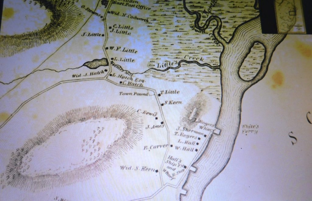
In the 1600’s an area called The New Marsh, later known as East Marshfield, was the entire northeast section, from Doggetts Ferry (Main St., Little’s Bridge) to the North & South Rivers’ mouth at Rexhame .   As the North River ran in  a northerly direction, a 70-acre, 70-foot high hill dominated the western bank of the river.  In  1638 a ferry-crossing was ordered by the Plymouth Colony Court on this hill’s eastern shore.
From top to bottom, Between Broad Creek and Little’s Creek,  a staging/mooring area for awaiting ships, was Pincin’s Bank. Then Rogers Wharf, the Ferry’s home, with a landing across the river to the Hummock’s. Next, J. Sherman, #1308, Ferry St. still exists. T. Rogers, Shipbuilder, no longer exists. L. Hall, the North River House, no longer exists.  W. Hall, site of the Bridgwaye Inn, next was Hall’s Shipyard and Wharf, & Blacksmith Shop. The unmarked Wharf was The Keene’s Yard, at the junction of The Ferry Rd. & Elm St.
This hill became known as  Ferry Hill, and the point where the Pilgrim Trail crossed the North River via a hand poled Ferry barge.
The Ferry Hill was covered with first growth trees…. White Pine, White and Red Oak, Chestnut, Black Walnut, Holly,  Elm, and Red  and  Sugar Maples, along with other species. Rose hips & beach plums covered the shoreline.
It was void of buildings until the early 1700’s.

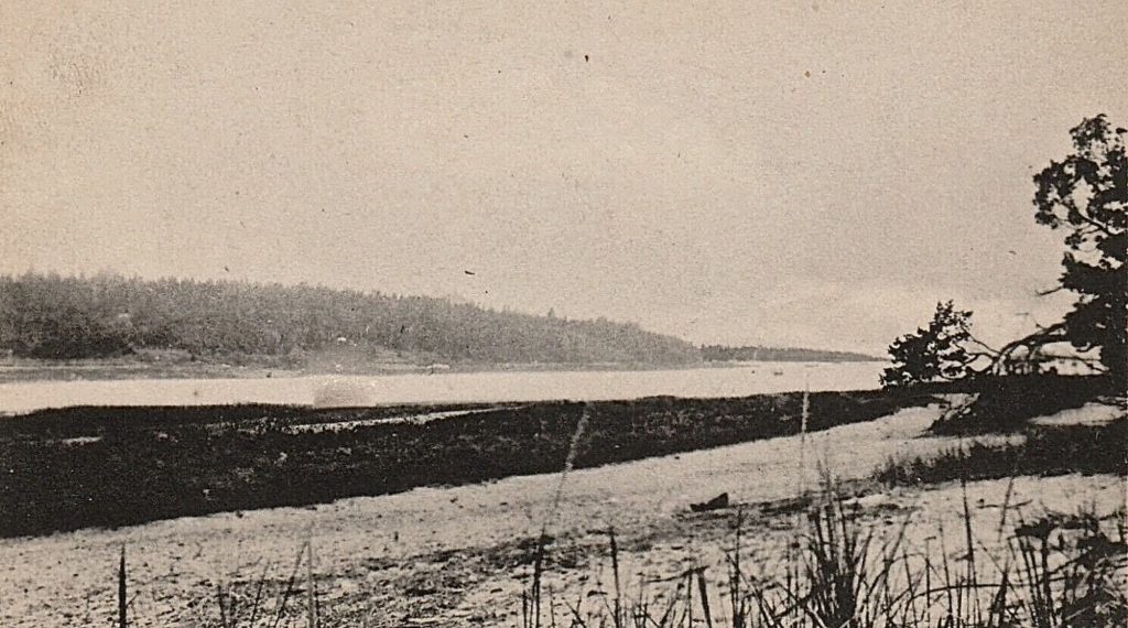
Looking northwest from the Hummocks (Humarock) to Ferry Hill.
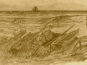
Roger’s Shipyard became the terminus and landing for the Ferry. This was beyond #1445 Ferry St. today.  Ferry hill was bordered by Elm St on it’s western border and The Ferry Rd. to the east & south.  No Sea St. until 1881-82.

                                      The Roger’s Wharf & Ferry Landing.

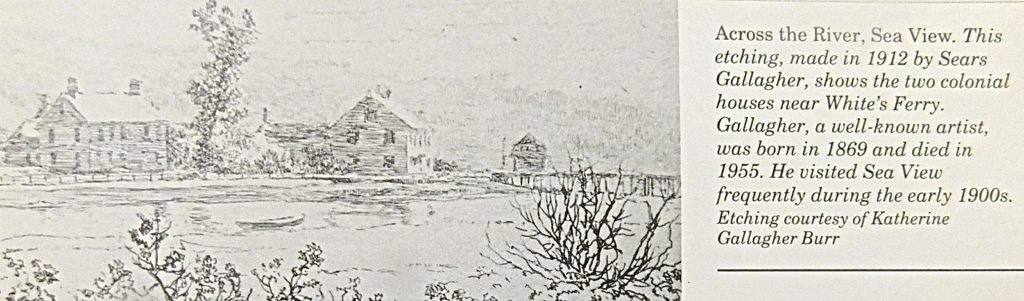
  Looking from Humarock,  northwest.  Left: William Hall residence,  now the site of the Bridgewaye Inn.  Center: the Luke Hall residence, The North River House.  Right: the Rogers Shipyard & Wharf. Also, the Ferry Landing.                     From Cynthia Hager Krusell’s book.
A fresh water stream ran parallel to Elm St, between Elm & the Ferry Hill.  At its high point, at Allerton Rd., it ran north to Little’s Creek where it became tidal.  It’s southern flow brought it into the marshland bordering Neptune Rd., and discharging across The Ferry Rd. into the river at the Hall’s Shipyard located on Capt. Day’s land.


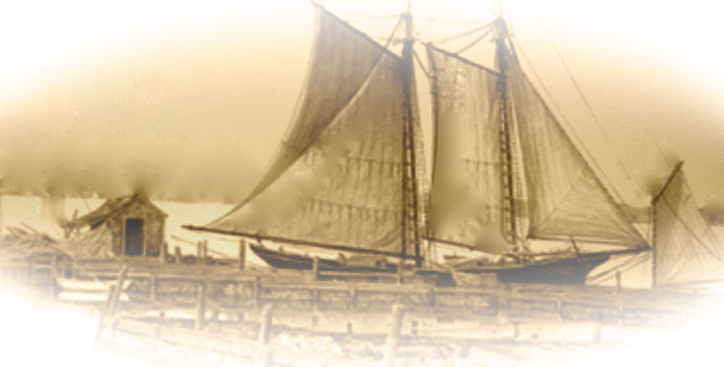
A finished rigged Schooner leaving the Rogers Yard for it’s maiden voyage.
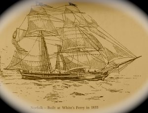
The “Norfolk”   Built at Whites Ferry.

The earliest record for a shipyard at the White’s Ferry area, was 1705.  This yard, Keene’s, harvested  timber from Ferry Hill, as well as Holly Hill, Carolina Hill and Centre Marshfield.  It didn’t take long to turn these areas into grazing land for cattle.
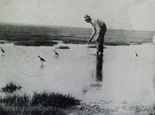
The North end of Ferry Hill was a shorebird and waterfowl mecca. Through the 1800’s a number of bird-hunting blinds could be found.

A shorebird hunter placing his decoys in Little’s Creek bordering the North of Ferry Hill.
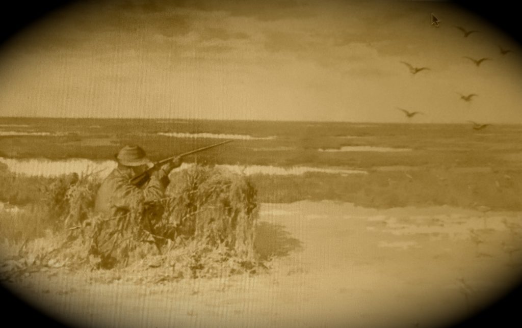
 

These blinds overlooked Little’s Creek, the North River marshes, also Pine, Tilden,  and Trouants Islands, along with Fourth Cliff.  A dozen or two of decoys brought Yellowlegs, Whimbrels, Long Billed Curlews, Black-Bellied & Golden Plovers and Sanderlings by the hundreds. The local-market gunners could shoot from before sun-up to dark, harvesting hundreds of birds. Bushel boxes  and wood barrels were filled.  The local hunters kept very quiet about their favorite and bounty-full locations.
In 1871, the Railroad came to Marshfield. The first station in Marshfield  was East Marshfield,  followed by Littletown ( Sea View) and Centre Marshfield , all within a short trip to the North River shore. Rumors of great bird-hunting soon reached the city.  Affluent out-of-town  sportsmen gradually got wind of these hunting spots. Sea View was only an hour’s trip from Boston.  The local market hunters quickly turned to guiding these deep-pocket sportsmen.   They  picked the gunners up and after the hunt, returned them to the Sea View Railroad Station to catch the last train home with their bounty.

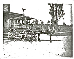
A horse &  wagon dropping off visitors & goods  at the Sea View Station

The local taverns, (Ye Surprise Inn), now (The Bridgewaye Inn)  and guest houses were also on the market-gunners’ list for a bushel or more of “Peeps” and ” Snipe”  to make a stew or pie for their guests.

Blinds were forced to move & began to lessen.  In 1918, a law was put on shorebirds  and waterfowl hunting which became controlled. Shorebirds were illegal to hunt and waterfowl now had designated seasons with a kill limit.
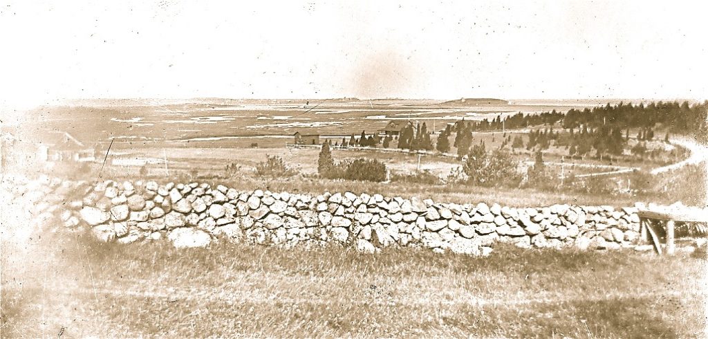
Looking northeast, overlooking the “New Marsh”.  Left, Victor Belanger’s cattle barn, Center, his boat house, George Ireland’s Club House, and Fourth Cliff in the distance.  On the right is Ferry Hill Rd, joining Grandview Ave.  Red Cedar trees now dominate the Hill… c.1860.
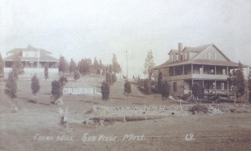
Looking S. with George Ireland’s  clubhouse (R.),  displacing a number of hunting blinds.

George Ireland , a businessman and land-developer, bought-up all the available land and laid out a plan of roads and lots in  1888.
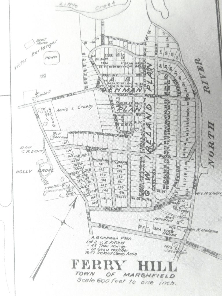
Note; the bridge to Humarock was called the Ferry Bridge and built in 1881-82. The now Bridgewaye Inn was the Sea View House. The North River Beverage was the Josselyn’s stables. The remains of the Rogers Wharf  and Shipyard/ Whites Ferry  show here.  Shipyards and the building of sailing ships now disappeared  in the late 1800’s.  The last Ship built on the North River was 1871.

These small lots were geared for tents and camps for George Ireland’s city friends and cronies.  Summer weekends attracted droves of campers from  30 to 50 miles away.
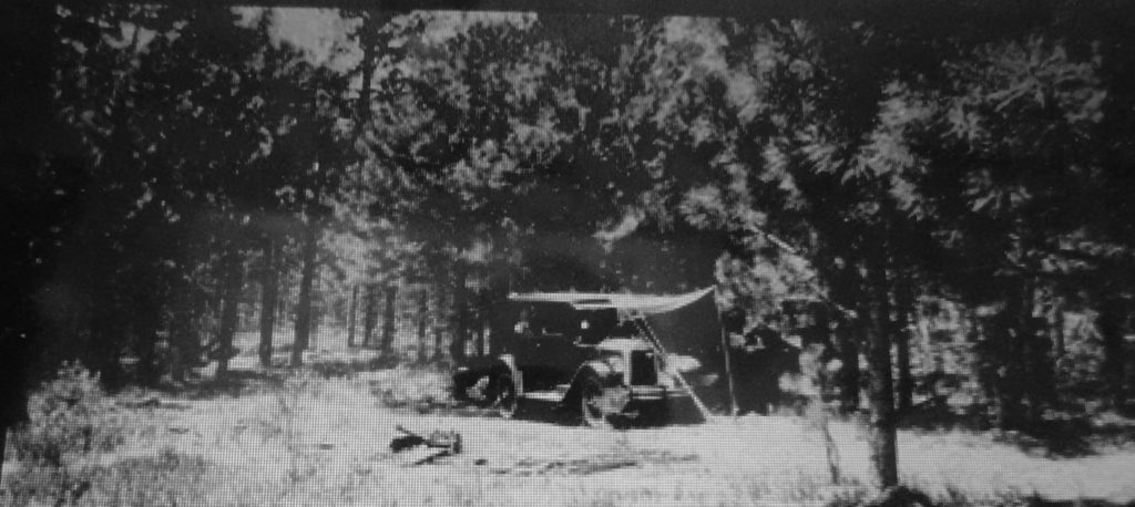
An early 30’s camper
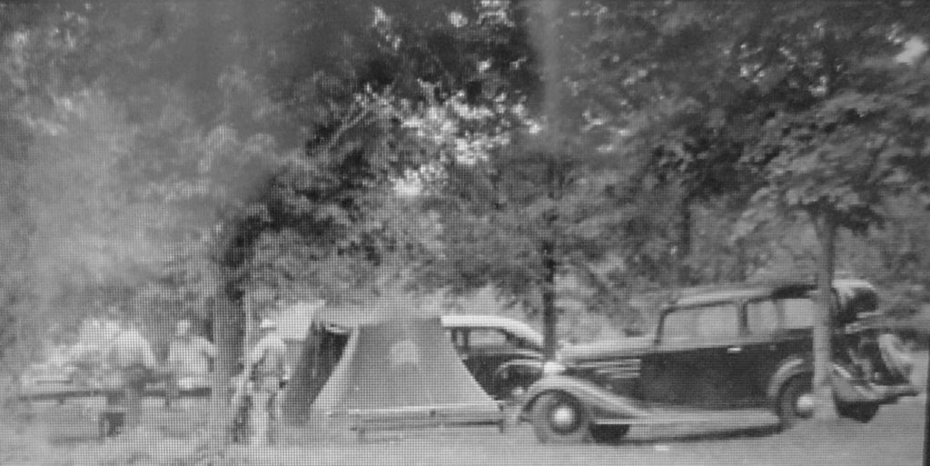
Mid 30’s.

Then came the platform tents.
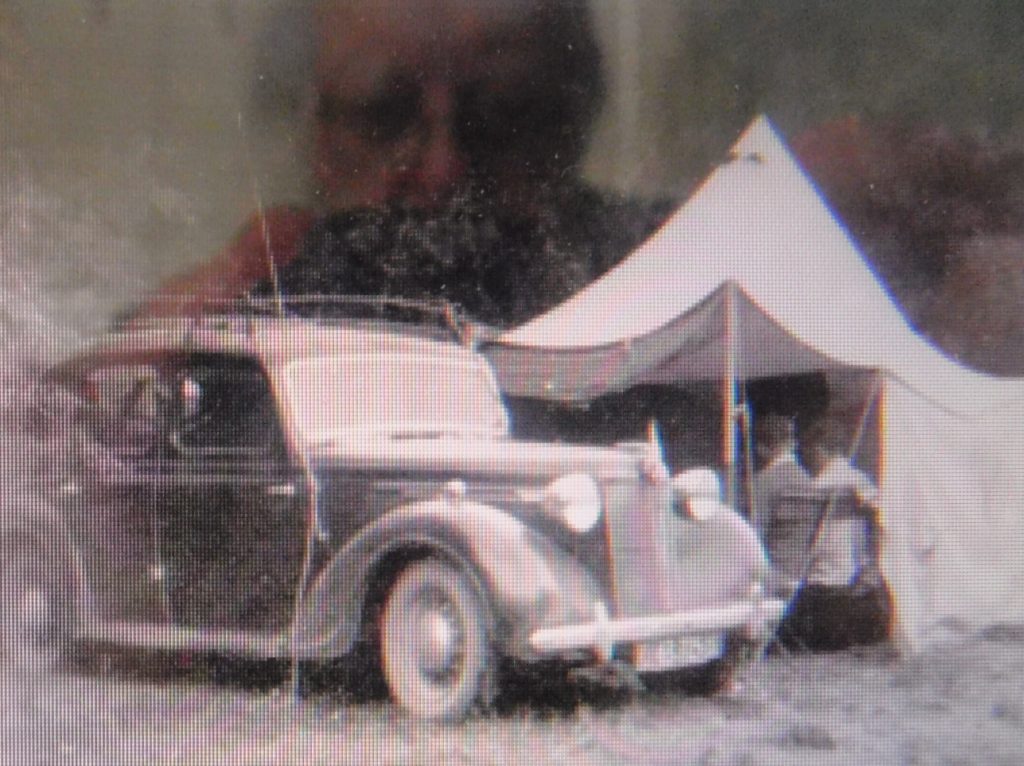
Lunch time.

Early camps used cheap boarding from a local mill.
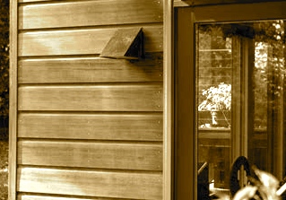

Followed by the popular novelty siding.

The Ferry Hill’s development was slowed down by the Great Depression with a short break of three years…..then stopped completely by WW ll for nearly 5 years.  It was then slow to get building materials.

In the mid-20’s the Crosby Water Co. built a pumping station and water storage tank on Ferry Hill.  Wells were established in the area, now known as The Thicket….a wetland  area with springs. This was developed to service Sea View  and  Humarock….the greatest demand coming from Humarock.  Public water suppliers were replacing outdated and contaminated private wells. Water lines were now found on most of the main roads in Marshfield.  By 1930 Ferry Hill was covered with a hundred homes or more.  Due to insufficient wastewater management, the wells became polluted and the Crosby
Water Co. shut down in 1946.
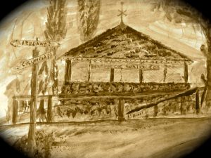
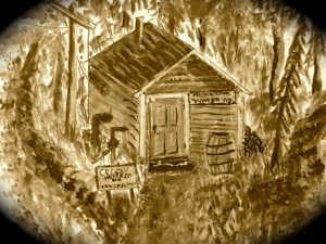
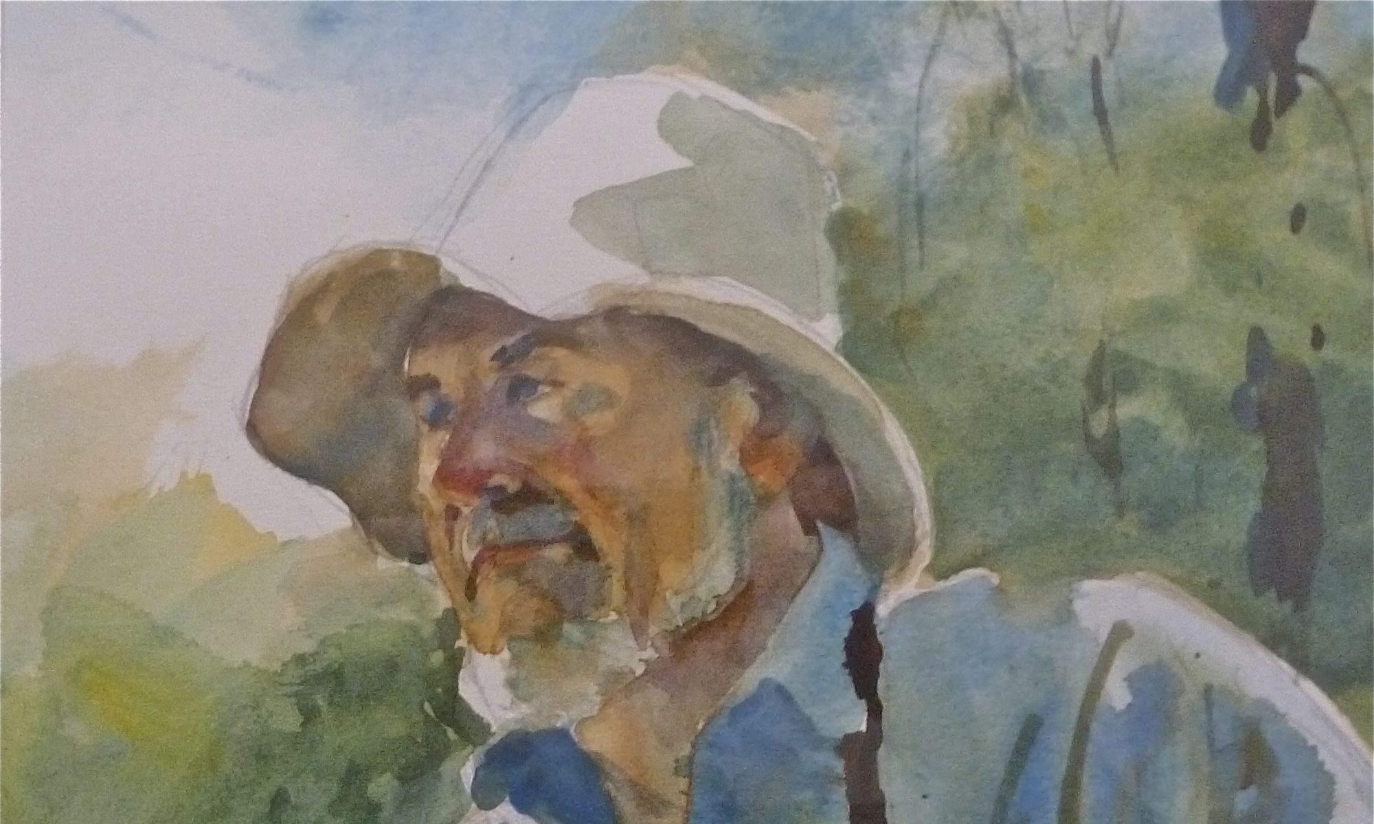
paintings by W. R. Freden.
Top: The water storage tank on Ireland Rd. opposite Carlton Rd.
Bottom:  The pumping house in the Thicket.
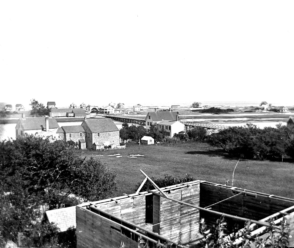


Just off Ireland Rd., an ice house was in construction to store ice for the demands of the Seaview Inn  (center), today’s Bridgwaye Inn.  c.1910, Left is the North River house.

Building-laws were creeping in and being enforced along with permits.
Tents disappeared, shacks were removed, building-lots became larger by adding adjoining-lots……allowing larger homes to be built.
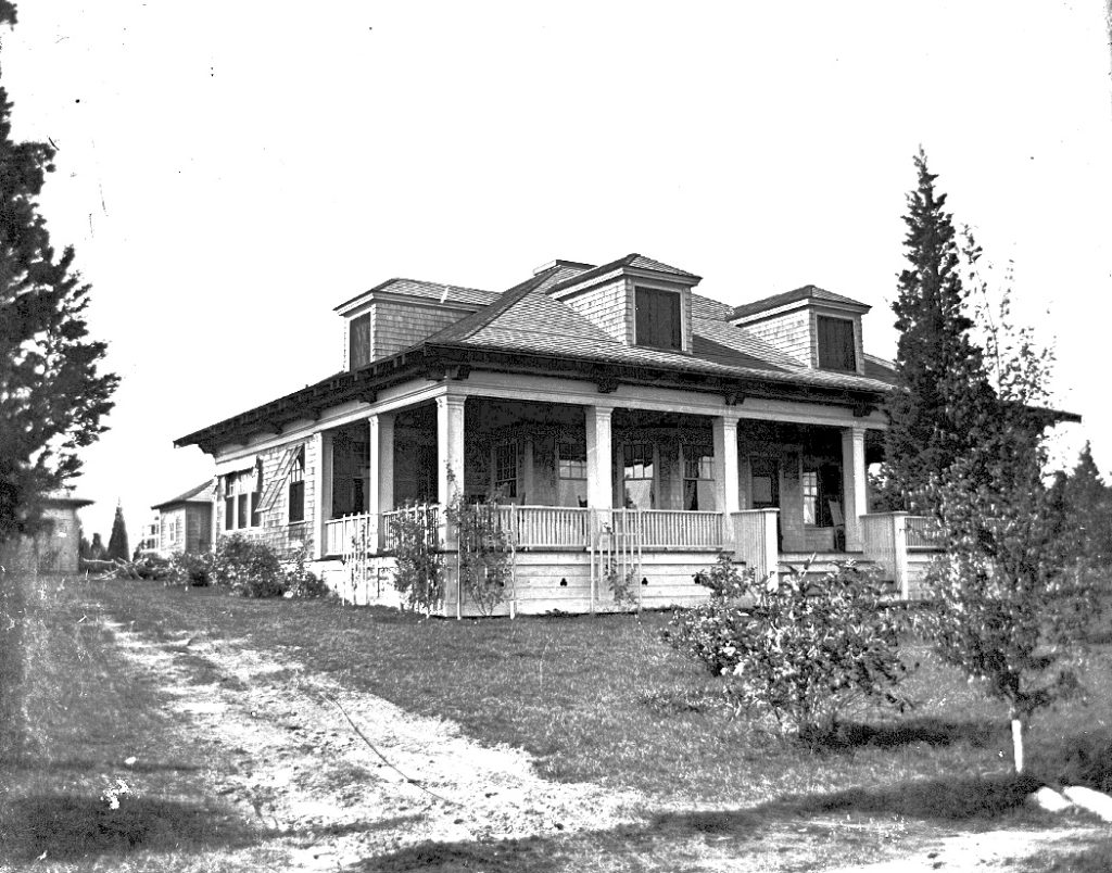
A stately home at 51 Carlton Rd. Built in 1903.


The residents and shipyard workers watched history developing every day of the year for 200 plus years.  Over 1000 ships were rigged and outfitted with supplies and goods at the Whites Ferry Yards.
There are too many Ships to list here,  but the “Columbia”  was the first ship to circumnavigate the Globe and the “Beaver” was involved in the Boston Tea Party.
This little community of East Marshfield, Little Town, Sea View contributed to  history that has touched our entire country and beyond.
And today it is barely recognized by any of the above names. Today, one rusty sign marks the general location of Whites Ferry.   The Village of Seaview is nearly lost , an insult to it’s history by the lack of recognition.  There are three  roads leading  into Seaview.  None have a sign stating ” WELCOME TO SEAVIEW, ” a village of shipbuilding.


W. Ray Freden Seaview/ Marshfield 70 years.
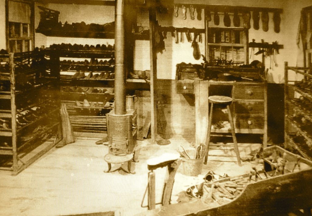
 

SHOE & BOOT MAKING IN MARSHFIELD

The 1867 Marshfield street listing shows over 90 men listed as shoemakers. that included cobblers .  Most records show these locations in the North & East Villages, however I found mention of a  cobblers shop in the area of the Marshfield Store.


A Shoemakers workshop.

A Cobblers/Shoemakers  shop at 63 Union St. operated by Calvin Joyce. c.1900

The Doane/ Stevens shop in Littletown, (changed to Sea View in 1883.)
The residence was moved from its location to the now 35 Station St. (once Summer St}  to allow the Railroad to build a Station at the now,  53 Station St.
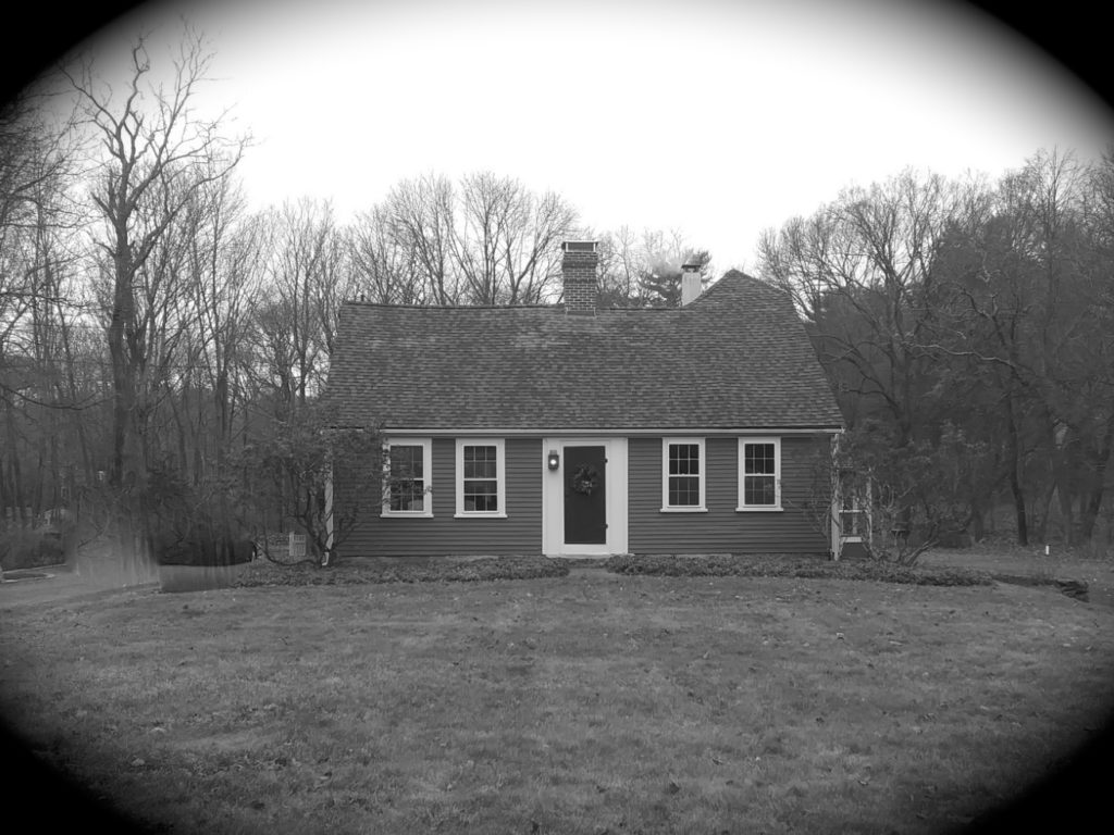
A two story Ell was added to this Cape Cod residence  to accommodate shoemaking  machinery  in rooms on the lower floor. Small rooms on the second floor were provided for  the workers that did not commute.
A large kitchen & a dinning room fed the workers three meals a day.
The Railroad next door provided shipping to the Shoe Markets.
The peak of the two story ell can be seen on the right roof line.

Thomas Stevens made a small fortune as a shoemaker and built a stately home across the street at 207 Summer St. in 1901.

Down the street at 110 Summer St. , a large general store was built by George Weatherbee Sr. and run by his son George Jr. from 1849 to 1852, It later  became the Gardner/Arnold Shoe Shop.
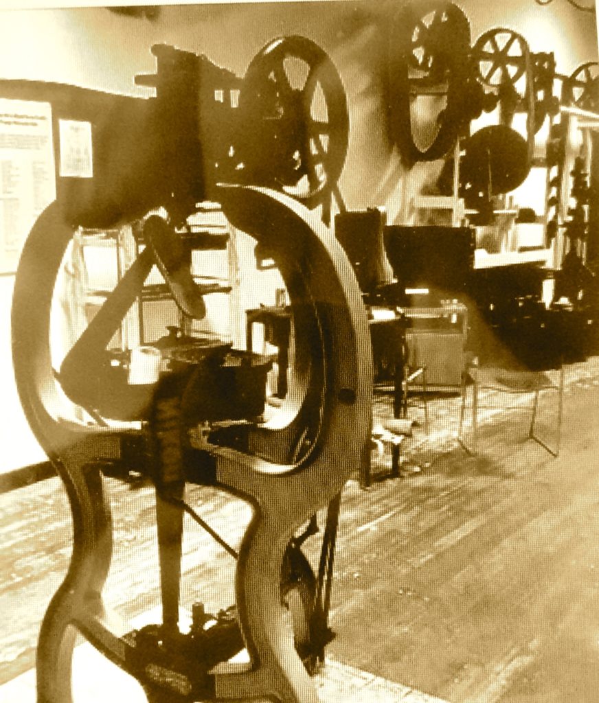
It was outfitted with state of the art machinery, the first sewing machines in town. In 1879.

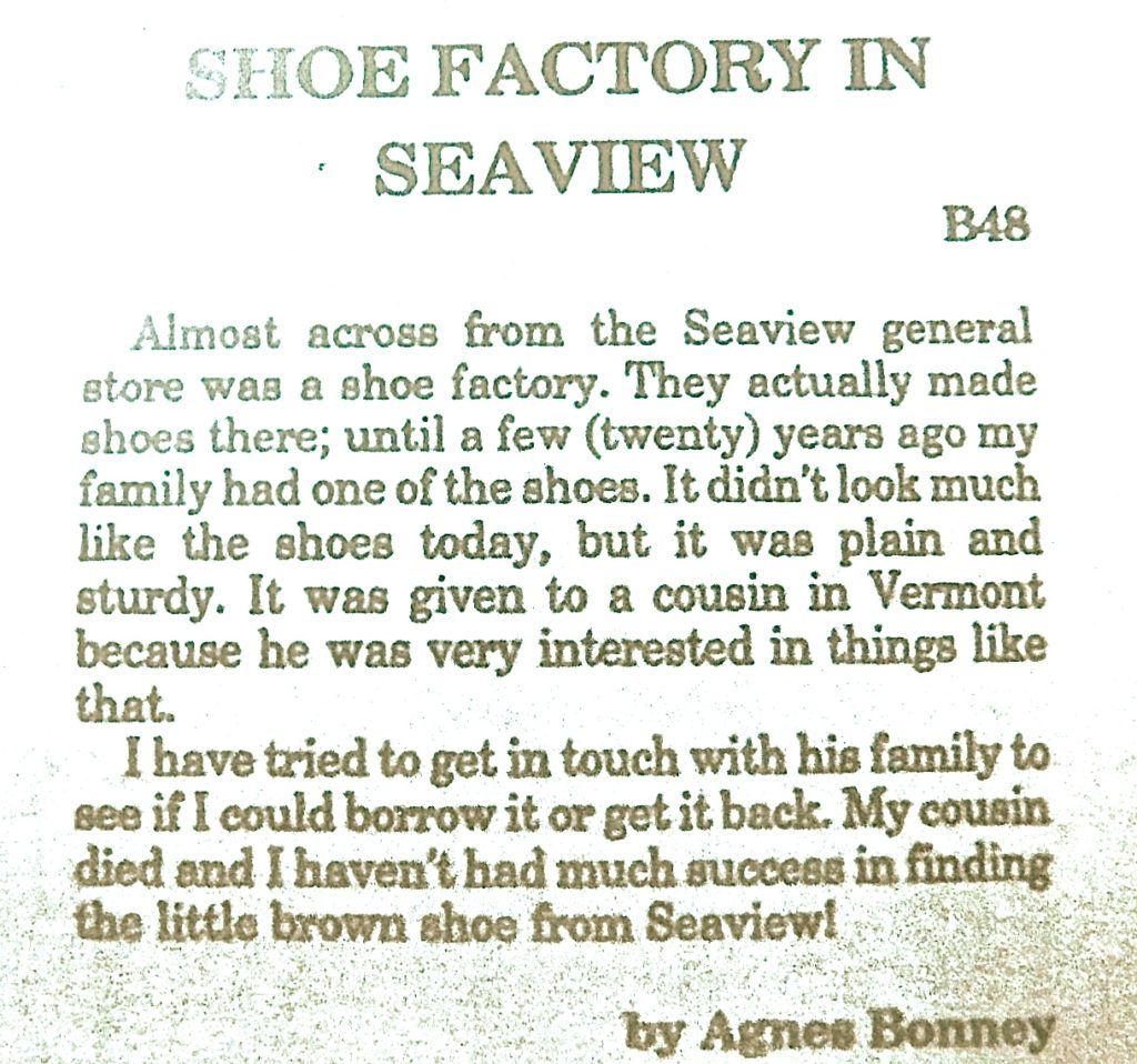
Agnes Josephine Bonney,  Former resident of 5 Station St.
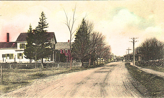
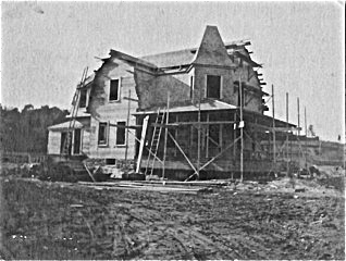
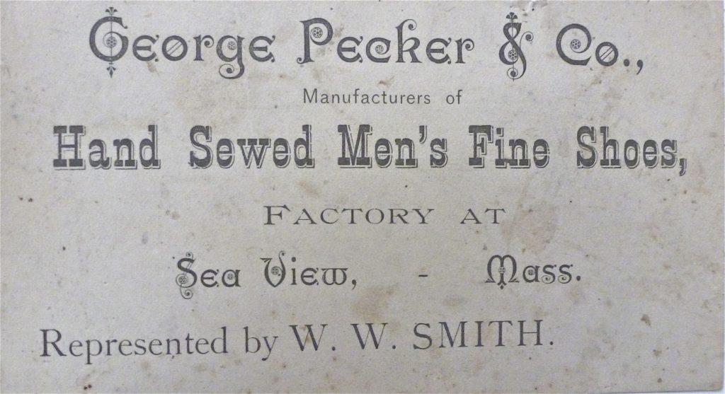
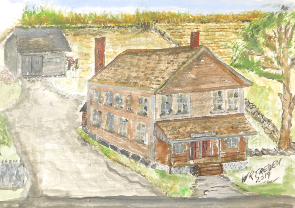
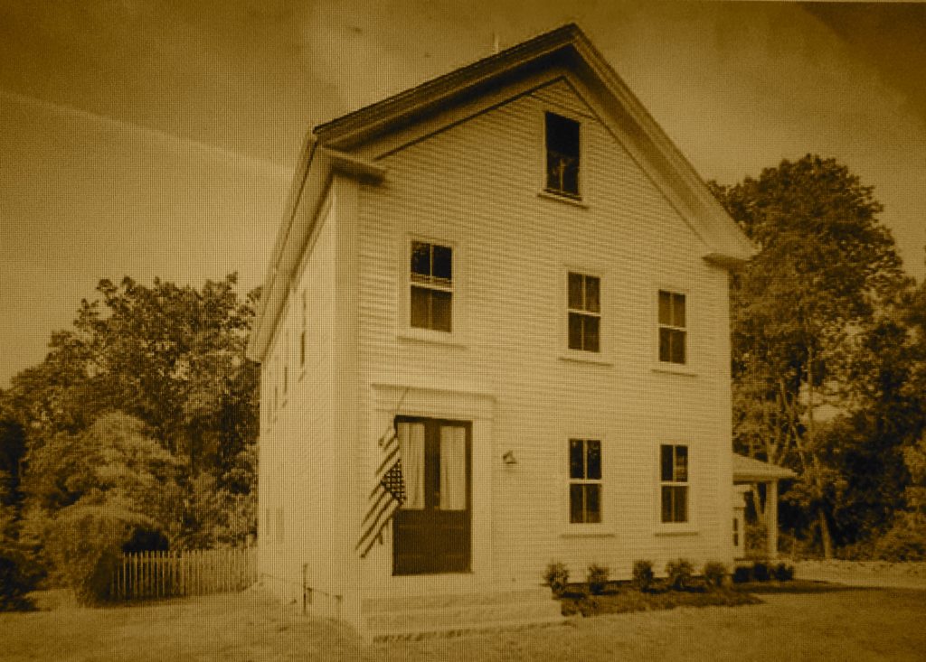
101 Summer St. looking north. The red building was the Gardner / Arnold Shoe Shop.  It was sold to George Pecker, a summer resident, and operated as a shoe shop short time.

It closed up shop in 1882. It then was vacant for a long time. It became a woodworking shop making many different wood products, model boats, bird houses, & novelties. It was acquired by the Donovan family in 1905.

Gardner / Arnold Shoeshop, 101 Summer St, Sea View.
Painting by W. Ray Freden 2019.

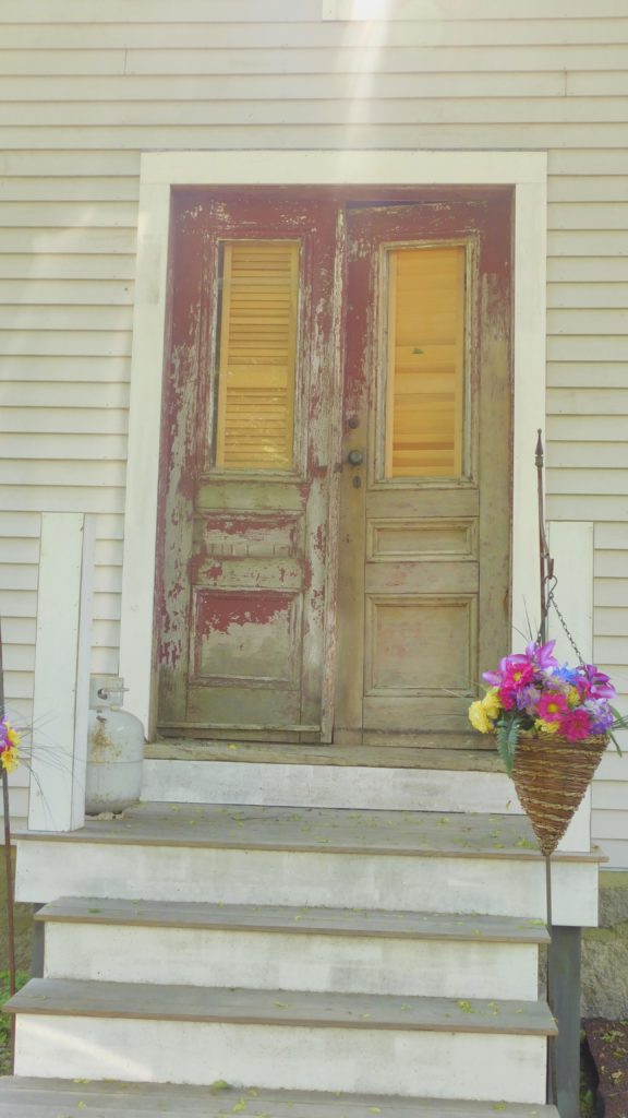
After it’s  long vacancy,  the building was razed  in 1950-1,  the front doors still  remain  on a small private  workshop in Seaview.

Now on a home shop in Seaview.

Another Shop at 88 Highland St. Lincoln Damond & Charles Tilden along with Albert Bates employing 15 to 25 shoemakers.

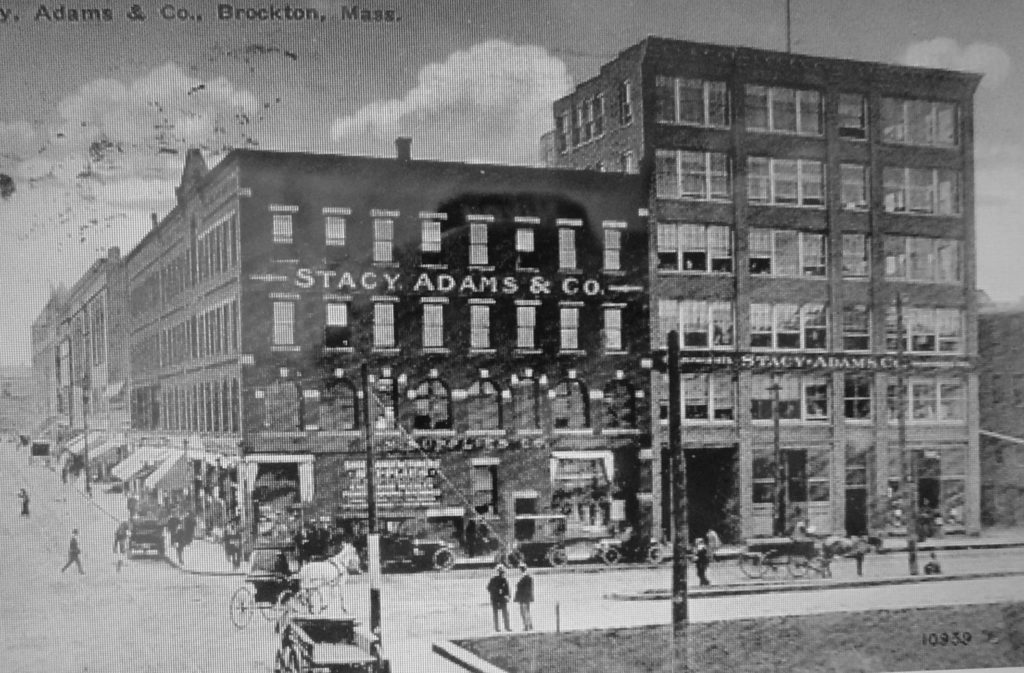
The small shoe industries gradually gave way to the large shoe factories in Brockton, Abington, Whitman, & other cities around Massachusetts & New Hampshire.
My Dad, Bill, along with his family were shoe factory employees. From a young age Bill worked in a large factory in Campello. He suggested to his boss that if they removed a hand operated lever from his machine,  and made it foot operated he could produce more.

Weeks later a machinist did alter the machine, in a short time Bill was out producing his coworkers by two to three times.  He got a raise & promoted to another duty, this new duty put more pressure on Bill than he wished. He chose to  quit,  He never returned to shoe-making.

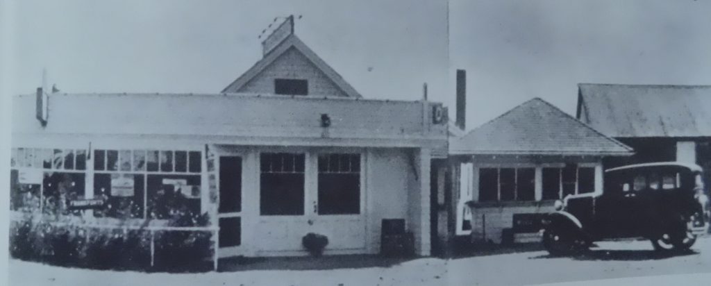
The last cobbler in Marshfield was located in the small shop behind the car. This was the block of buildings east of Marshfield Radio & Television owned by Russ Chandler, Ocean St.
I am sure there were more home industry shoemakers in Marshfield,

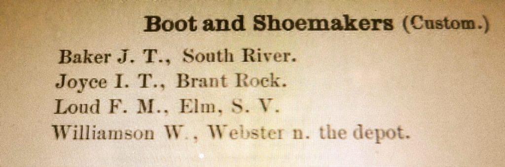
The 1884 Street listing shows these Custom Shoemakers.


” I have three soles, left, right and all of the above.”
“It seems , there are more heels around  than there are shoes.”
“Have you noticed that a lot of sneakers are  holding their tongues .”


The above quotes by W. Ray Freden .


W. Ray Freden, Seaview/Marshfield 70 years.


Snow Rollers & Snow Donuts

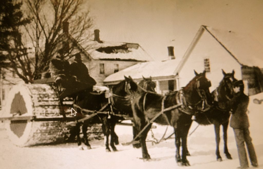
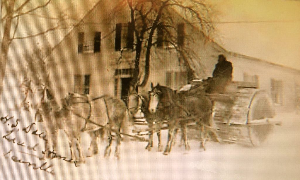
I had been aware of the Snow Rollers used before snow plowing. They were large wooden barrels designed to be pulled with a team of horses or oxen.

I was told that a vintage roller could be seen  
                                    off Summer St., Seaview,  in a back yard of an                                                    old farm house for years. c. 1940’s.

Snow wasn’t removed from the roads but simply packed down to be walked on or ridden over by horse or horse & wagon.

Another kind of Snow Roller.
My wife & I, along with our two boys, were in for a huge surprise.
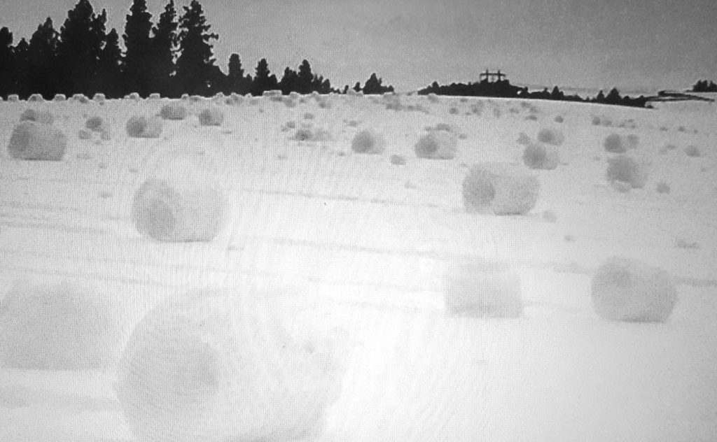
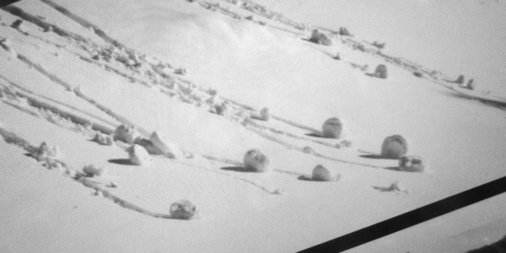
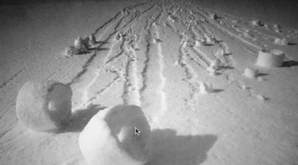
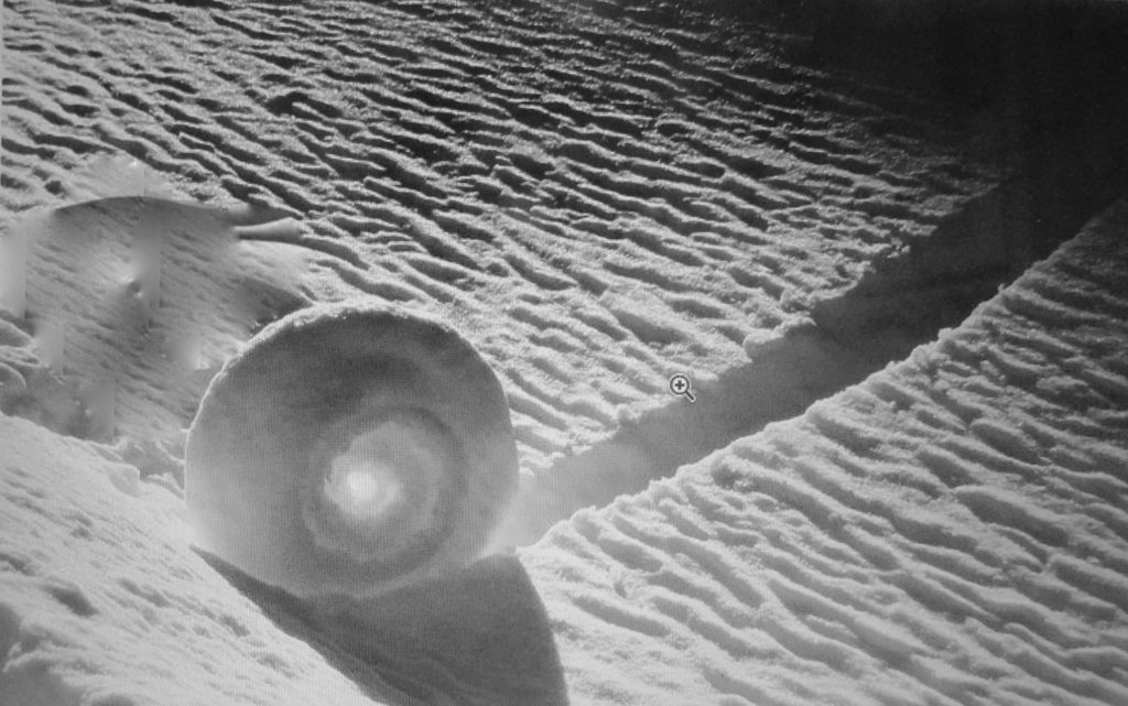
After a visit to a friend’s lodge in Stowe, Vermont, and a long weekend of skiing, eating & indulging, we were  returning home on Rte.  100 southbound  through Waterbury.  A long high hill came into view and was full of lumps.  These lumps looked like donuts or jelly-rolls made from snow.  Both my wife and I were dumbfounded.  Never in our lives had we seen such a display of this mystery in the snow.  Well our oldest son pipes up and said “Dad, they are snow rollers!”  Huh?  “Ya, Dad, I saw a photo on the Lodge wall, and I was told about them. The snow has to be just right and a steady amount of wind blows a ball downhill  collecting more snow.”

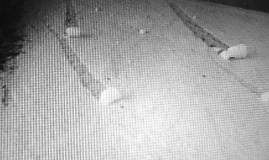
My 35 mm camera was out of film, but I had a  B&W camera for emergency’s. I used up the 12 photos fast and as best I could from my lane that now was collecting traffic. I just couldn’t understand how the wind could ever get under the snow and lift it into a windblown donut .

‘A snow roller is a rare meteorological phenomenon in which cylindrical snowballs are formed naturally.  Chunks of snow roll downhill or are blown along the ground by wind, picking up more snow along the way,  much the same way that the large snowballs used in snowmen are made. They can be as small as a tennis ball, but they can also be bigger than a car.’


Both the above & below photos show the rollers had almost jumped the snow bank into Rte 100, Waterbury, Vt. c. late 70’s.

This was a “once-in-a-lifetime” experience, a sight that we will never forget.

Snow rollers are also known as “snow bales,” “wind snowballs” or “snow donuts.”
W. Ray Freden, Seaview/ Marshfield, 70 years. Down East Maine 18 years.